West Walton
| West Walton | |
|---|---|
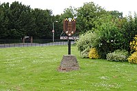
 The Village sign, West Walton, Norfolk |
|
| West Walton shown within Norfolk | |
| Area | 15.77 km2 (6.09 sq mi) |
| Population | 1,731 (parish, 2011 census) |
| • Density | 110/km2 (280/sq mi) |
| OS grid reference | TF4713 |
| • London | 105 miles (169 km) |
| Civil parish |
|
| District | |
| Shire county | |
| Region | |
| Country | England |
| Sovereign state | United Kingdom |
| Post town | WISBECH |
| Postcode district | PE14 |
| Dialling code | 01945 |
| Police | Norfolk |
| Fire | Norfolk |
| Ambulance | East of England |
| EU Parliament | East of England |
| UK Parliament | |
West Walton is a village and a civil parish in the English county of Norfolk The village is 56.5 miles (90.9 km) west of Norwich, 13.9 miles (22.4 km) west-south-west of King's Lynn and 105 miles (169 km) north of London. The nearest town is Wisbech which is 2.6 miles (4.2 km) south of the village. The nearest railway station is at Watlington, Norfolk for the Fen Line which runs between King's Lynn and Cambridge. The nearest airport is Norwich International Airport. The parish of West Walton, in the 2001 census, has a population of 1659, increasing to 1,731 at the 2011 census. For the purposes of local government, the parish falls within the district of King's Lynn and West Norfolk.
The village and parish of West Walton is located in the western part of the county of Norfolk. The western flank of the parish is also the county border between Norfolk and Cambridgeshire and is also the course of the River Nene. On the southern flank is the parish of Walsoken. To the north is Walpole and to the east is Marshland St James. The name West Walton is thought to derive from the Old English meaning of the settlement by the wall which refers to the village's proximity to a Roman sea wall or defence.
West Walton was established by the time of the Norman Conquest. The village's population, land ownership and productive resources were detailed in its entry in the Domesday Book of 1085. In the great book West Walton is recorded by the name Waltuna. The parish was held by William de Warenne with the Abbot of St peter and St Paul, Cluny from him, The Abbot of Ely before and after 1066, and Oder from Ralph de Beufour. The survey mentions ½ Church, 38 Salt Houses and 1100 sheep. the survey also records the presence of a fishery. In the Domesday survey fractions were used to indicate that the entry, in this case the church, was situated within more than one parish.
...
Wikipedia

