West Wales Airport
|
West Wales Airport West Wales/Aberporth Airport |
|||||||||||
|---|---|---|---|---|---|---|---|---|---|---|---|
| Summary | |||||||||||
| Airport type | Public | ||||||||||
| Operator | West Wales Airport Ltd. | ||||||||||
| Serves | Cardigan | ||||||||||
| Location | Aberporth | ||||||||||
| Elevation AMSL | 428 ft / 130 m | ||||||||||
| Coordinates | 52°06′53″N 004°33′34″W / 52.11472°N 4.55944°WCoordinates: 52°06′53″N 004°33′34″W / 52.11472°N 4.55944°W | ||||||||||
| Map | |||||||||||
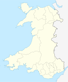
| Location in Wales | |||||||||||
| Runways | |||||||||||
|
|||||||||||
Aberporth Airport (ICAO: EGFA) is an airport near the village of Aberporth, in the county of Ceredigion, West Wales. The site is being developed as West Wales Airport for domestic flights within Wales and the rest of the United Kingdom. The airport is also developing as a centre for the deployment of civil and military unmanned aerial vehicles (UAVs), also known as 'drones'. The airport underwent major improvements in 2008 which extended the length of the runway from 945 to 1,257 m (3,100 to 4,124 ft).
The following military units were posted here at some point:
The nearby M.o.D. range is used for testing rockets by the British military, as well as for launching civil rockets for atmospheric research.
Aberporth Aerodrome has a CAA Ordinary Licence (Number P859) that allows flights for the public transport of passengers or for flying instruction as authorised by the licensee. The aerodrome is not licensed for night use.
...
Wikipedia

