West Hills, Los Angeles, California
| West Hills | |
|---|---|
| Neighborhood of Los Angeles | |

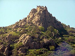
Escorpión Peak (aka: Castle Peak) (1,475 feet/450 m)—east face view from West Hills.
|
|
 West Hills as delineated by the Los Angeles Times |
|
| Location within Los Angeles/San Fernando Valley | |
| Coordinates: 34°12′14″N 118°37′44″W / 34.204°N 118.629°W | |
| Country | United States |
| State | California |
| County | Los Angeles |
| City | Los Angeles |
| Owensmouth | 1912 |
| Canoga Park | 1930 |
| West Hills | 1987 |
| Area | |
| • Total | 8.53 sq mi (22 km2) |
| Elevation | 900 ft (274 m) |
| Population (2008) | |
| • Total | 41,426 |
| • Density | 4,551/sq mi (1,757/km2) |
| Time zone | PST (UTC-8) |
| ZIP code | 91304 & 91307 |
| Area code(s) | 818 & 747 |
West Hills is a residential and commercial neighborhood in the western San Fernando Valley region of Los Angeles, California. The percentage of residents aged 35 and older is among the highest in Los Angeles County.
The neighborhood was formerly the home of many Native American tribes, and during the early Spanish and Mexican era was part of the Mission San Fernando Rey de España. In the American era, West Hills was part of Owensmouth, which was renamed Canoga Park in 1930. West Hills was established in western Canoga Park and retained its present name in 1987.
Historic landmarks and many city parks are to be found within the community, as are commercial districts, a business district and religious establishments. Two private high schools are among the thirteen schools within West Hills.
West Hills (formerly joined with Canoga Park) is located in the West San Fernando Valley (SFV) in the county of Los Angeles and about 30 minutes (depending on traffic) from Downtown Los Angeles. It is off of the 101 Ventura freeway offramp Valley Circle Blvd/Mullholland Highway.
According to the Mapping L.A. project of 2008, the Los Angeles Times, West Hills is flanked on the north by the Chatsworth Reservoir, on the east by Canoga Park, on the south by Woodland Hills, on the southwest by Hidden Hills and on the west by Bell Canyon in Ventura County.
In 1987, Los Angeles recognized the following description of the boundaries of West Hills Neighborhood Council:
Starting at the centerline intersections of Topanga Canyon Boulevard and Nordhoff Street, westward down the centerline of Nordhoff extended in a straight line to the city limits of the City of Los Angeles; thence southward, following the border of the City of Los Angeles to the centerline of Victory Boulevard; thence eastward down the centerline of Victory Boulevard to Shoup Avenue centerline; thence northward down the centerline of Shoup Avenue to the intersection of the centerline of Roscoe Boulevard; thence eastward down the centerline of Roscoe Boulevard to the centerline of Topanga Canyon Boulevard; then northward down the centerline of Topanga Canyon Boulevard to the centerline of Nordhoff Street.
...
Wikipedia

