Welch, Oklahoma
| Welch, Oklahoma | |
|---|---|
| Town | |
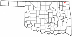
 Location of Welch, Oklahoma |
|
| Coordinates: 36°52′29″N 95°5′38″W / 36.87472°N 95.09389°WCoordinates: 36°52′29″N 95°5′38″W / 36.87472°N 95.09389°W | |
| Country | United States |
| State | Oklahoma |
| County | Craig |
| Area | |
| • Total | 0.5 sq mi (1.2 km2) |
| • Land | 0.5 sq mi (1.2 km2) |
| • Water | 0.0 sq mi (0.0 km2) |
| Elevation | 820 ft (250 m) |
| Population (2010) | |
| • Total | 619 |
| • Density | 1,238.0/sq mi (515.8/km2) |
| Time zone | Central (CST) (UTC-6) |
| • Summer (DST) | CDT (UTC-5) |
| ZIP code | 74369 |
| Area code(s) | 539/918 |
| FIPS code | 40-79750 |
| GNIS feature ID | 1099471 |
Welch is a town in Craig County, Oklahoma, United States. The population was 619 at the 2010 census, an increase of 3.7 percent from 597 in 2000. It is the second largest town in its county.
Welch was established in 1888 in the Cherokee Nation on land that D. B. Nigh leased from Frank Craig. The Missouri, Kansas and Texas Railway (Katy) had built a line through the area in 1871, and in 1891 it built a switch on Nigh's property, providing a shipping point for local hay and grain. The town that began to grow around the switch was named for a Katy railroad official, A. L. Welch. A post office was established in 1892. The town plat was approved in 1902, and the town incorporated in 1909.
A established the first school in 1899, then sold it to the city in 1907. The first class graduated in 1911.
Welch is located at 36°52′29″N 95°5′38″W / 36.87472°N 95.09389°W (36.874605, -95.093805). It is 18 miles (29 km) north of Vinita, the county seat, and 13 miles (21 km) west of Miami, the county seat of Ottawa County.
According to the United States Census Bureau, the town has a total area of 0.5 square miles (1.3 km2), all land.
As of the census of 2000, there were 597 people, 247 households, and 170 families residing in the town. The population density was 1,308.7 people per square mile (501.1/km²). There were 295 housing units at an average density of 646.7 per square mile (247.6/km²). The racial makeup of the town was 75.38% White, 0.17% African American, 12.90% Native American, 1.34% from other races, and 10.22% from two or more races. Hispanic or Latino of any race were 2.18% of the population.
...
Wikipedia
