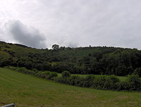
Wavering Down
| Site of Special Scientific Interest | |
 |
|
| Area of Search | Somerset |
|---|---|
| Grid reference | ST385555 to (grid reference ST430560) |
| Coordinates | 51°17′43″N 2°52′53″W / 51.2952°N 2.8814°WCoordinates: 51°17′43″N 2°52′53″W / 51.2952°N 2.8814°W |
| Interest | Biological and Geological |
| Area | 332.2 hectares (3.322 km2; 1.283 sq mi) |
| Notification | 1952 |
| Natural England website | |
Crook Peak to Shute Shelve Hill is a 332.2 hectare (820.9 acre) geological and biological Site of Special Scientific Interest near the western end of the Mendip Hills, Somerset. The line of hills runs for approximately 5 kilometres (3.1 mi) from west to east and includes: Crook Peak, Compton Hill, Wavering Down, Cross Plain and Shute Shelve Hill. Most of the site is owned by the National Trust who bought 725 acres (293 ha) in 1985, and much of it has been designated as common land. It was notified as an SSSI by Natural England in 1952.
The ecology of the area includes ancient woodland and calcareous grassland which supports nationally rare species including the Cheddar pink. The underlying rocks are Carboniferous Limestone containing phreatic caves at Shute Shelve Cavern and Picken's Hole from which fossils dating from the Middle Devensian have been recovered.
The site extends for some 5 kilometres (3.1 mi) from west to east. Near its eastern end it is divided by a gap used by the A38 road and the disused Cheddar Valley railway line. At the western end of the hills, closest to the M5 motorway, is Crook Peak which reaches 191 metres (627 ft), and forms a prominent feature from the surrounding landscape. Evidence of early human occupation of Crook Peak includes a polished flint axe. It was used as the site of a beacon at the time of the Spanish Armada. A ridge to the south east of Crook Peak, known as 'The Razor', is used by the West Mendip Soaring Association to fly model aircraft when the wind is a south-westerly, southerly or north-easterly direction.
...
Wikipedia

