Wattle Grove, Western Australia
|
Wattle Grove Perth, Western Australia |
|||||||||||||
|---|---|---|---|---|---|---|---|---|---|---|---|---|---|

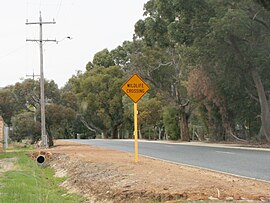
Crystal Brook Road, Wattle Grove
|
|||||||||||||
| Coordinates | 32°00′29″S 116°00′50″E / 32.008°S 116.014°ECoordinates: 32°00′29″S 116°00′50″E / 32.008°S 116.014°E | ||||||||||||
| Population | 4,119 (2011 census) | ||||||||||||
| Postcode(s) | 6107 | ||||||||||||
| Location | 13 km (8 mi) E of Perth, Western Australia | ||||||||||||
| LGA(s) | Shire of Kalamunda | ||||||||||||
| State electorate(s) | |||||||||||||
| Federal Division(s) | Hasluck | ||||||||||||
|
|||||||||||||
Wattle Grove is a suburb of Perth, Western Australia, located within the Shire of Kalamunda.
Wattle Grove is approximately 3/4 Semi Rural, and 1/4 Urban Development. It contains some of Hartfield Park, and extends from Crystal Brook Road to Roe Highway. Major Transport Routes through the suburb are Welshpool Road, Hale Road, Tonkin Highway and Roe Highway.
Bus routes are
The nearest Train stations are
Playgrounds are located throughout the new subdivisions in the suburb, as well as walking and bike paths leading to newly created artificial lakes.
Wattle Grove is served by Wattle Grove Primary School, and a Community TAFE Centre in Lewis Road and the Bible College of Western Australia (Private). The new primary school built on the area bordered by St John Road, Tomah Road, and Acastus Road opened to students in 2011. The old primary school on Welshpool road was mothballed with no alternative usage envisioned.
Hartfield Recreation Centre, located nearby, provides gymnasium facilities as well as opportunities for playing Rugby League, Soccer, Baseball, Cricket, Tennis. Hartfield Park also contains the Darling Range Horse and Pony Club, the Hartfield Country Club (Golf Course), Boy Scouts, and Car Club rooms.
Wattle Grove is well connected to other regions of Perth due to its proximity to the Roe Highway and Tonkin Highway. The most direct route to the Perth CBD is via Welshpool / Shepperton Roads (12 km all in 60 km/h zones), however alternative routes are available via Orrong Road / Graham Farmer Freeway (14 km in 70 & 80 km/h zones), Tonkin Highway / Great Eastern Highway (18 km in 100 & 60 km/h zones), and Roe Highway / Kwinana Freeway (23 km all in 100 km/h zone and the only route without traffic lights).
...
Wikipedia

