Warehorne
| Warehorne | |
|---|---|
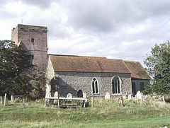
 St Matthew's church |
|
| Warehorne shown within Kent | |
| Area | 10.66 km2 (4.12 sq mi) |
| Population | 370 (2011)(Civil Parish) |
| • Density | 35/km2 (91/sq mi) |
| OS grid reference | TQ986329 |
| Civil parish |
|
| District | |
| Shire county | |
| Region | |
| Country | England |
| Sovereign state | United Kingdom |
| Post town | Ashford |
| Postcode district | TN26 |
| Dialling code | 01233 |
| Police | Kent |
| Fire | Kent |
| Ambulance | South East Coast |
| EU Parliament | South East England |
| UK Parliament | |
Warehorne is a village and civil parish in the south of the Ashford Borough of Kent, England. It is a scattered community centred on the Hamstreet to Tenterden road (B2067) around seven miles SSW of Ashford. The Royal Military Canal passes through the south of the civil parish.
The settlement is in four main parts:
...
Wikipedia

