Walrus Islands
|
Walrus Islands Archeological District
|
|
|
Alaska Heritage Resources Survey
|
|

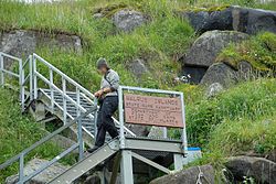
Entrance to Round Island, Alaska
|
|
| Location | Bristol Bay, Alaska |
|---|---|
| Coordinates | 58°41′16″N 160°08′20″W / 58.68764°N 160.13878°W |
| Area | 9,187 acres (3,718 ha) |
| NRHP Reference # | 100000875 |
| AHRS # | XHI-093; XNB-145 |
| Significant dates | |
| Added to NRHP | December 23, 2016 |
| Designated NHLD | December 23, 2016 |
58°42′40″N 160°15′51″W / 58.71101°N 160.26409°WCoordinates: 58°42′40″N 160°15′51″W / 58.71101°N 160.26409°W
The Walrus Islands (Russian: Моржовые острова) are a group of craggy coastal islands in the Bering Sea, close to the northern shores of Bristol Bay, Alaska at the entrance to Togiak Bay. They are located 18 km to the east of Hagemeister Island, and are protected as the Walrus Islands State Game Sanctuary by the state. A part of the island group is also of archaeological importance, with numerous deeply stratified sites covering 6,000 years of human use. For this reason, Crooked Island, Summit Island and Round Island were designated the Walrus Islands Archeological District, a National Historic Landmark District comprising 14 historical sites, in December 2016.
The Walrus Islands consist of a small group of islands and rocky islets extending to the southeast. The main islands are: Summit Island (close to the coast), High Island, Crooked Island, Black Rock Island and Round Island, not to be confused with Round Island (Aleutian Islands). The longest island is Crooked Island with a length of 10 km from north to south. The highest point is 69 m. Administratively these islands belong to the Dillingham Census Area, Alaska.
...
Wikipedia

