Waldridge Fell
| Waldridge Fell | |
| Site of Special Scientific Interest | |
|
Calluna vulgaris heathland surrounding a rain-fed pond on Waldridge Fell
|
|
| Country | England |
|---|---|
| Region | North East |
| District | County Durham |
| Location |
NZ245503 to NZ253486 |
| - coordinates | 54°50′25″N 1°36′38″W / 54.84028°N 1.61056°WCoordinates: 54°50′25″N 1°36′38″W / 54.84028°N 1.61056°W |
| Area | 113.5 ha (280.46 acres) |
| Notification | 1965 / 1981 |
| Management | Natural England |
| Area of Search | County Durham |
| Interest | Biological |
| Website: Map of site | |
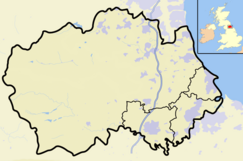
Waldridge Fell is a Site of Special Scientific Interest located immediately south-west of Chester-le-Street in the northern part of County Durham, England. It is one of the largest areas of lowland heath in County Durham and contains the only lowland valley-mire in the county. The fell is home to a number of plants and insects that are scarce to rare elsewhere in the county.
Waldridge Fell was first notified as an SSSI in 1965. The designated area was revised in 1985, the boundary being extended in some places, while portions around Waldridge village were deleted from the SSSI.
The area is important as one of the largest expanses of lowland heath in County Durham, which is close to northern limit for this type of habitat, and is one of the few such areas in North East England. Lowland heath is a threatened habitat in the United Kingdom, which holds around 20 per cent of the world's stock of the habitat: over the last 200 years some 80 percent of the lowland heath in England has been destroyed, and in the UK as a whole only 44 per cent of the area that existed before 1940 still remains.
Also significant is that the Wanister Bog, an area of seasonally-flooded wetland on the south-east side of the fell, is the only valley-mire in lowland County Durham.
The area currently designated as an SSSI occupies 113.5 ha, of which 98.5 ha is classed as dwarf shrub heath, 13 ha is broadleaved woodland, and the remainder is marsh.
The SSSI shares a common boundary on the south-west side with Daisy Hill Local Nature Reserve, while the north-east corner abuts the Cong Burn Wood Local Nature Reserve.
Waldridge Fell SSSI is a broadly rectangular area, lying between the valleys of two tributaries of the River Wear, the Cong Burn to the north-west and the South Burn to the south-east. Most of the area lies between 80 and 120 metres above sea level, with a high point of 129 metres.
...
Wikipedia


