Waldheim–Rochlitz railway
| Waldheim–Rochlitz (Sachs) | ||||||||||||||||||||||||||||||||||||||||||||||||||||||||||||||||||||||||||||||||||||||||||||||||||||||||||||||||||||||||||||||
|---|---|---|---|---|---|---|---|---|---|---|---|---|---|---|---|---|---|---|---|---|---|---|---|---|---|---|---|---|---|---|---|---|---|---|---|---|---|---|---|---|---|---|---|---|---|---|---|---|---|---|---|---|---|---|---|---|---|---|---|---|---|---|---|---|---|---|---|---|---|---|---|---|---|---|---|---|---|---|---|---|---|---|---|---|---|---|---|---|---|---|---|---|---|---|---|---|---|---|---|---|---|---|---|---|---|---|---|---|---|---|---|---|---|---|---|---|---|---|---|---|---|---|---|---|---|---|
|
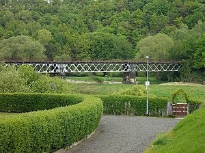
Bridge across Zwickauer Mulde between Rochlitz and Döhlen
|
||||||||||||||||||||||||||||||||||||||||||||||||||||||||||||||||||||||||||||||||||||||||||||||||||||||||||||||||||||||||||||||
| Route number: | 528 (1997) | |||||||||||||||||||||||||||||||||||||||||||||||||||||||||||||||||||||||||||||||||||||||||||||||||||||||||||||||||||||||||||||
| Line number: | 6631; WR | |||||||||||||||||||||||||||||||||||||||||||||||||||||||||||||||||||||||||||||||||||||||||||||||||||||||||||||||||||||||||||||
| Line length: | 20.690 km | |||||||||||||||||||||||||||||||||||||||||||||||||||||||||||||||||||||||||||||||||||||||||||||||||||||||||||||||||||||||||||||
| Track gauge: | 1435 | |||||||||||||||||||||||||||||||||||||||||||||||||||||||||||||||||||||||||||||||||||||||||||||||||||||||||||||||||||||||||||||
| Maximum incline: | 17,2 % | |||||||||||||||||||||||||||||||||||||||||||||||||||||||||||||||||||||||||||||||||||||||||||||||||||||||||||||||||||||||||||||
| Minimum radius: | 210 m | |||||||||||||||||||||||||||||||||||||||||||||||||||||||||||||||||||||||||||||||||||||||||||||||||||||||||||||||||||||||||||||
|
||||||||||||||||||||||||||||||||||||||||||||||||||||||||||||||||||||||||||||||||||||||||||||||||||||||||||||||||||||||||||||||
The Waldheim–Rochlitz railway was a single-track branchline of about 21 km length in Saxony, connecting the towns of Waldheim and Rochlitz via Hartha and Geringswalde. It was opened in 1893, closed in 1998 and served mainly the purposes of the local industry and population.
First attempts to have a railway built between Waldheim and Rochlitz were made in the 1870s. The towns of Geringswalde and Hartha had a particular interest in it, as they expected advantages for their further economic development. A first petition to the Saxon parliament in 1871 was rejected by the First Chamber. Another petition in 1872, supported by Geringswalde, Hartha, Rochlitz, and Waldheim unterstützt wurde, was also rejected, and further attempts in the following years remained without success. Instead of the Waldheim–Rochlitz line, a railway from Schweikershain to Colditz via Geringswalde and Lastau and a branch line connecting Hartha to Waldheim were discussed in the 1870s.
While first rentability studies were permitted in 1882, the project was rejected again in 1883. In a new petition of 12 November 1883 the communities declared themselves ready to purchase the necessary land at their own expenses. In December 1883 the mayor of Geringswalde presented himself at ministries and railway deputations in Dresden. With a petition dated 7 November 1887 the towns of Geringswalde, Hartha, Rochlitz, and Waldheim complained to the Second Chamber of the Saxon Parliament about the slow progress.
Finally, preparatory work for a branch line was permitted in 1888 and began in 1889. Permission for the actual construction was given on 13 March 1890 by the Second Chamber of the Saxon Parliament, and shortly thereafter by the First Chamber. However, the exact route, in particular the location of Hartha station, had not been decided upon yet. A station close to the town center would have made the line about one kilometre longer, and would have required two more bridges, while a shorter, more southern route would have meant a greater distance of the station from the town. Despite the wishes of neighbouring communities, the supporters of the southern route prevailed. As a consequence, Geringswalde station was also built south of the town. Two options were considered for the route to Rochlitz, a northern one along Auenbach brook or a southern one along Aubach brook; due to the larger number of communities and the more favourable gradients along the latter, the southern route was selected.
...
Wikipedia

