Waihola
|
Waihola Waihora |
|
|---|---|
| Town | |

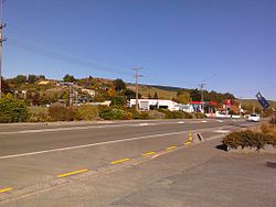
Main street of Waihola
|
|
| Location of Waihola | |
| Coordinates: 46°2′0″S 170°6′0″E / 46.03333°S 170.10000°ECoordinates: 46°2′0″S 170°6′0″E / 46.03333°S 170.10000°E | |
| Country | New Zealand |
| Region | Otago |
| District | Clutha |
| Government | |
| • Type | District Council |
| • Body | Clutha District Council |
| • Mayor | Bryan Cadogan |
| • Bruce Ward Councillor (Chair, Corporate Services Committee) | Gaynor Finch |
| • Bruce Ward Councillor | Joanna Lowrey |
| • Bruce Ward Councillor (Chair, Regulatory Services Committee) | Bruce Vollweiler |
| Population (2006 Census) | |
| • Total | 249 |
| PO Box Lobby Postcode (Waihola, Waihola) | 9243 |
| Rural Delivery Postcode (RD 1, Outram) | 9073 |
| International telephone access and area code | 03 |
| ISO 3166 code | 554 |
The township of Waihola lies between Dunedin and Milton, New Zealand in Otago, in New Zealand's South Island. It lies close to the southeast shore of the shallow tidal lake which shares its name.
The town is located on State Highway 1, and the South Island Main Trunk rail line runs through it, though trains no longer stop. The township is within the boundaries of Clutha District.
Waihola is a popular destination for day-trips from Dunedin, 35 kilometres to the north, and the lake is a venue for many water sports, including waterskiing, rowing, and yachting.
Te Ara Encyclopaedia of New Zealand page with video
Main road of Waihola looking north
Houses and a petrol station in Waihola
Houses in Waihola
...
Wikipedia

