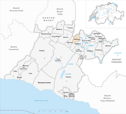
Vuibroye
| Vuibroye | ||
|---|---|---|
| Former municipality of Switzerland | ||
|
||
| Coordinates: 46°34′N 06°48′E / 46.567°N 6.800°ECoordinates: 46°34′N 06°48′E / 46.567°N 6.800°E | ||
| Country | Switzerland | |
| Canton | Vaud | |
| District | Lavaux-Oron | |
| Government | ||
| • Mayor | Bernard Matthey | |
| Area | ||
| • Total | 1.41 km2 (0.54 sq mi) | |
| Elevation | 639 m (2,096 ft) | |
| Population (2010) | ||
| • Total | 124 | |
| • Density | 88/km2 (230/sq mi) | |
| Demonym(s) | Les Châtre-truies | |
| Postal code | 1610 | |
| SFOS number | 5802 | |
| Surrounded by | Auboranges (FR), Oron-la-Ville, Châtillens, Essertes | |
| Website | Profile (French), SFSO statistics |
|
Vuibroye is a former municipality in the district of Lavaux-Oron in the canton of Vaud in Switzerland. The municipalities of Bussigny-sur-Oron, Châtillens, Chesalles-sur-Oron, Ecoteaux, Oron-la-Ville, Oron-le-Châtel, Palézieux, Les Tavernes, Les Thioleyres and Vuibroye merged on 1 January 2012 into the new municipality of Oron.
Vuibroye had an area, as of 2009[update], of 1.4 square kilometers (0.54 sq mi). Of this area, 1.16 km2 (0.45 sq mi) or 82.9% is used for agricultural purposes, while 0.15 km2 (0.058 sq mi) or 10.7% is forested. Of the rest of the land, 0.12 km2 (30 acres) or 8.6% is settled (buildings or roads), 0.01 km2 (2.5 acres) or 0.7% is either rivers or lakes.
Of the built up area, housing and buildings made up 6.4% and transportation infrastructure made up 2.1%. Out of the forested land, 5.0% of the total land area is heavily forested and 5.7% is covered with orchards or small clusters of trees. Of the agricultural land, 57.1% is used for growing crops and 23.6% is pastures, while 2.1% is used for orchards or vine crops. All the water in the municipality is flowing water.
The former municipality was part of the Oron District until it was dissolved on 31 August 2006, and Vuibroye became part of the new district of Lavaux-Oron.
The blazon of the municipal coat of arms is Argent, two Bars wavy Azure, overall a Lion rampant Or.
...
Wikipedia


