Vinelz
| Vinelz | ||
|---|---|---|
|
||
| Coordinates: 47°2′N 7°6′E / 47.033°N 7.100°ECoordinates: 47°2′N 7°6′E / 47.033°N 7.100°E | ||
| Country | Switzerland | |
| Canton | Bern | |
| District | Seeland | |
| Area | ||
| • Total | 4.57 km2 (1.76 sq mi) | |
| Elevation | 460 m (1,510 ft) | |
| Population (Dec 2015) | ||
| • Total | 860 | |
| • Density | 190/km2 (490/sq mi) | |
| Postal code | 3234 | |
| SFOS number | 0502 | |
| Surrounded by | Brüttelen, Erlach, Ins, Lüscherz, Twann | |
| Website |
www SFSO statistics |
|
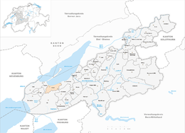
Vinelz is a municipality in the Seeland administrative district in the canton of Bern in Switzerland.
Vinelz is first mentioned in 1228 as Fenis. The municipality was formerly known by its French name Fenil, however, that name is no longer used.
There were extensive Neolithic and Bronze Age settlements along the shore of Lake Biel, which stretch into Lüscherz. Inland an Early Bronze Age settlement has been discovered at Schattewil, while Roman settlements were found at Mieschzälg and Flachseren. During the Middle Ages it was part of the Herrschaft of Erlach. In 1474 all the Erlach lands, including Vinelz, were acquired by Bern. Under Bernese rule it became part of the new bailiwick of Erlach. In 1691, Emanuel Gaudard, a citizen of Bern, built the Landsitz (country manor house) Obere Budlei in the village.
The village church of St. Mary's was first mentioned in 1228. It was probably founded by the Counts of Fenis, who ruled from the nearby Fenis or Hasenburg Castle. The church was decorated with murals during the 14th century and rebuilt in 1484. Following the Protestant Reformation in 1528, the patronage rights over the church transferred to Bern. The Vinelz parish includes the nearby municipality of Lüscherz.
In the 1960s new vacation and weekend homes changed the agricultural character of village. Restaurants, three campgrounds and a marina have changed Vinelz into a tourist center on Lake Biel.
Vinelz has an area of 4.57 km2 (1.76 sq mi). Of this area, 2.36 km2 (0.91 sq mi) or 51.6% is used for agricultural purposes, while 1.62 km2 (0.63 sq mi) or 35.4% is forested. Of the rest of the land, 0.64 km2 (0.25 sq mi) or 14.0% is settled (buildings or roads) and 0.01 km2 (2.5 acres) or 0.2% is unproductive land.
...
Wikipedia


