Vermilion River (Louisiana)
| Vermilion River | |
| River | |
|
Vermilion River in Abbeville.
|
|
| Country | United States |
|---|---|
| State | Louisiana |
| City | Lafayette, LA |
| Source | Confluence of bayous |
| - location | Saint Landry Parish, LA, United States |
| Mouth | Gulf of Mexico |
| - location | Intracoastal, Vermilion Parish, LA, United States |
| Length | 70 mi (113 km) |
|
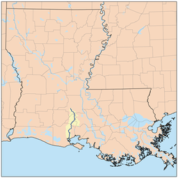
Vermilion River watershed
|
|
The Vermilion River (or the Bayou Vermilion) is a 70.0-mile-long (112.7 km)river in southern Louisiana in the United States. It is formed on the common boundary of Lafayette and St. Martin parishes by a confluence of small bayous flowing from St. Landry Parish, and flows generally southward through Lafayette and Vermilion parishes, past the cities of Lafayette and Abbeville. At the port of Intracoastal City, the Gulf Intracoastal Waterway crosses the river before the latter flows into Vermilion Bay, an inlet of the Gulf of Mexico. The river originates at Bayou Fusilier, which is fed by Bayou Teche; winds its way through Lafayette Parish; and drains into the Vermilion Bay below Vermilion Parish.
The river is a "consequent stream" or a "tidal river", which means that the Vermilion was formed from the bottom up. The river was created by Vermilion Bay: tides and other natural actions in the bay slowly eroded the marshes and other features of the landscape as the river crept northward. This process brought the channel that would one day become the Vermilion River as far north as Lafayette, Louisiana. Much later a distributary of Bayou Teche made its way south and eventually linked up with the consequent stream, forming a true north-south flowing river. During times of heavy-rain events, parts of the Vermilion will reverse and flow north (Citation needed). The reverse-flow phenomenon occurs because the watershed areas in the city of Lafayette are highly developed. Rainfall runoff from this urban area enters the Vermilion River with larger volumes and at a faster rate than runoff upstream. This raises the water level in the Vermilion River along the southern areas of Lafayette. This rise in water levels sometimes exceeds the water level in reaches upstream of Lafayette, thus causing the reverse-flow effect. Also, when water levels in the Vermilion River exceed certain stages, water begins to enter the Bayou Tortue Swamp Area. This swamp has a great capacity to hold water, which also contributes to the reverse flow effect. The water from the Vermilion River enters Bayou Tortue Swamp through two coulees. Coulee Crow and Bayou Tortue are located upstream of the Surrey Street bridge on the Vermilion River.
...
Wikipedia


