Utah State Route 103
| State Route 103 | ||||
|---|---|---|---|---|
| 650 North | ||||

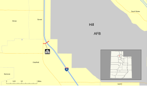
SR-103 highlighted in red
|
||||
| Route information | ||||
| Defined by Utah Code §72-4-116 | ||||
| Maintained by UDOT | ||||
| Length: | 0.225 mi (0.362 km) | |||
| Existed: | April 19, 1965 – present | |||
| Major junctions | ||||
| West end: |
|
|||
|
|
||||
| East end: | Falcon Hill National Aerospace Research Park entrance | |||
| Highway system | ||||
|
||||
State Route 103 (SR-103) is a 0.225-mile-long (362 m) urban minor arterial state highway in the U.S. state of Utah. It branches off from SR-126 (Main Street) in downtown Clearfield and extends east to Interstate 15 (I-15), terminating at the entrance to the Falcon Hill National Aerospace Research Park, just outside Hill Air Force Base. The entire route is located in Davis County and was formed in 1965 coinciding with the construction of I-15. The route has been mostly unchanged since its formation, except for the moniker of the highway and the route number of its western terminus.
The western terminus, in a stretch of fourteen years from its inception, has gone from SR-1 in 1965, to SR-106 in 1967, to SR-84 in 1969, and SR-126 in 1979. In 1979, the moniker of the roadway for SR-103 was changed from 600 North to 650 North. SR-103 is one of four Utah state highways that connect to Hill Air Force Base, the others being SR-97, SR-168, and SR-232. Only SR-168 has a lower average daily traffic count, with roughly 1,000 vehicles-per-day traveling along the highway compared to SR-103's approximately 16,000 vehicles-per-day. The only major change to the highway since its formation was the addition of traffic lights at the on and off ramps for I-15.
State Route 103 (SR-103) begins at an intersection with SR-126, locally known as Main Street in Clearfield. At this intersection, 650 North, which continues the right-of-way, lengthens from a two lane local street into a four lane arterial boulevard at SR-126. SR-103 begins its progression eastward, passing between two commercial complexes. After a crossing of the Davis Weber Canal, the sidewalk on the southern side of the roadway turns to the south to follow the canal forming the Clearfield Canal Trail. SR-103 highway turns to the northeast, intersecting with the southbound on-ramp and off-ramp to Interstate 15 (I-15). After this intersection, SR-103 expands to five lanes, and crosses under the southbound and northbound lanes of I-15. After the overpasses, SR-103 intersects with the northbound on-ramp and off-ramp from I-15. The highway progresses straight for about 300 ft (91 m), passing a gated fence on the north side of the highway leading to a rail stub, and the dead-end of Aspen Avenue, before reaching the entrance to the Falcon Hill National Aerospace Research Park, just outside Hill Air Force Base, the designated eastern terminus of SR-103. From there, the right-of-way continues on the arterial in the base itself.
...
Wikipedia

