Uige Province
| Uige | |
|---|---|
| Province | |

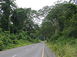
Caxito-Uíge Road
|
|
 Map of Angola with the Uige province highlighted |
|
| Country |
|
| Alvor Agreement | January 15, 1975 |
| Capital | Uige |
| Government | |
| • Governor | Paulo Pombolo |
| Area | |
| • Total | 58,698 km2 (22,663 sq mi) |
| Population (2014 census) | |
| • Total | 1,426,354 |
| • Density | 24/km2 (63/sq mi) |
| ISO 3166 code | AO-UIG |
| Website | www |
Uíge (/wiːdʒ/), one of the eighteen Provinces of Angola, is located in the northwestern part of the country. Its capital city is of the same name. Municipalities within the province include Alto Cauale, Ambuila, Bembe, Buengas, Bungo, Damba, Macocola, Milunga, Mucaba, Negage, Puri, Quimbele, Quitexe, Sanza Pombo, Songo, Uíge, and Zombo.
Beginning in October 2004 and continuing into 2005, Uige Province was the centre of an outbreak of Marburg hemorrhagic fever, a disease closely related to Ebola. According to the United Nations, it was, at the time, the world's worst epidemic of any kind of hemorrhagic fever.
During the Middle Ages, the Uige Province was the heartland of the Kongo Kingdom. The Bakongo North and South of the Kongo river were all part of this Kingdom, a centralized monarchy which for given periods of time also dominated part of the Ambundu further to the South. The kings lived in the city of Mbanza-Kongo which had a population of about 50,000 in the 16th century. Knowledge of metallurgy among the Bakongo was renowned; their king was even called the “Blacksmith King”. Their reign was first strengthened by the arrival Portuguese priests who lived at the king's court and taught religion as well as literacy; the interaction with the Portuguese stronghold of Luanda was rather marginal for a long time. Things changed when the Portuguese started to conquer and occupy the hinterland in the 19th century. In the beginning of the 20th century, the Kongo kingdom still existed on paper and the court in Mbanza Kongo was maintained, but had lost any effective power.
...
Wikipedia
