US 74
| U.S. Route 74 | |||||||
|---|---|---|---|---|---|---|---|
 |
|||||||
| Route information | |||||||
| Length: | 515 mi (829 km) | ||||||
| Existed: | 1927 – present | ||||||
| Tourist routes: |
|
||||||
| Major junctions | |||||||
| West end: |
|
||||||
|
|||||||
| East end: | Lumina Avenue in Wrightsville Beach, NC | ||||||
| Location | |||||||
| States: | Tennessee, North Carolina | ||||||
| Highway system | |||||||
|
|||||||
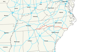
In the U.S. state of Tennessee and North Carolina, U.S. Route 74 (US 74) is an east–west United States highway that runs for 515 miles (829 km) from Chattanooga, Tennessee to Wrightsville Beach, North Carolina. Predominantly in North Carolina, it serves as an important highway from the mountains to the sea, connecting the cities of Asheville, Charlotte and Wilmington.
US 74 was designated in 1927. The 63-mile (101 km) route travels from the I-24/I-75 interchange, in Chattanooga, northeast to Cleveland, where it then continues east, along with US 64, to the North Carolina state line. The highway is predominantly freeway or expressway grade four-lane, except between Ocoee and Ducktown, where it is a curvy two-lane mountain highway along the .
TDOT's signage for US 74 is poor. Most highways that cross it will typically only list I-75 or US 64 instead; I-75 completely ignores US 74 along its route, even ignoring it at their intersection, showing instead a connector to US 64.
...
Wikipedia

