U.S. Route 65 (Arkansas)
| U.S. Route 65 | |
|---|---|
 |
|
| Route information | |
| Length: | 966 mi (1,555 km) |
| Existed: | 1926 – present |
| Major junctions | |
| South end: |
|
|
|
| North end: |
|
| Location | |
| States: | Louisiana, Arkansas, Missouri, Iowa, Minnesota |
| Highway system | |
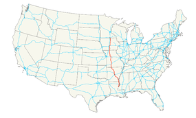
U.S. Route 65 is a north–south United States highway in the southern and midwestern United States. The southern terminus of the route is at U.S. Route 425 in Clayton, Louisiana. The northern terminus is at Interstate 35 just south of Interstate 90 in Albert Lea, Minnesota. Parts of its modern route in Iowa and historic route in Minnesota follow the old Jefferson Highway.
U.S. 65 begins in Clayton, Louisiana and proceeds northward to Waterproof, St. Joseph, and Newellton, all in Tensas Parish. At Newellton, it intersects with Louisiana State Highway 4 coming from the west. In Tallulah, it intersects Interstate 20, and approximately 30 miles north of this intersection it enters Arkansas.
US 65 enters the southeast corner of Arkansas just north of Gassoway, Louisiana. It is designated as part of Arkansas' Great River Road from this point north through Lake Village, McGehee, and Dumas. The Great River Road continues east onto US 165, while US 65 continues northwest to Pine Bluff.
US 65 originally entered Pine Bluff traveling northwest along Harding Avenue, turning north along Ohio Street, then west through downtown along 5th and 6th Avenues, where northbound traffic used 5th and southbound traffic used 6th, before converging onto 6th Avenue west of downtown. The highway then turned north along Blake Street and followed Dollarway Road, now designated Arkansas Highway 365, northwest into White Hall.
...
Wikipedia

