Tyson Wash
| Tyson Wash | |
| Desert Wash | |
|
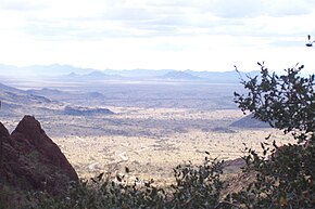
View due west from Palm Canyon
(dirt road climbs beige alluvial fan) (in foreground) Trigo Mountains, south, Dome Rock Mountains, north (farthest horizon: (in California): Chocolate, Palo Verde & Little Chuckwalla mountain ranges) |
|
| Country | United States |
|---|---|
| State | Arizona |
| Region | Lower Colorado River Valley NW-Sonoran Desert (SE-Mojave Desert-(NW & N)) |
| Municipality | Quartzsite |
| Borders on | La Posa Plain |
| Coordinates | 33°39′54.000″N 114°13′15.000″W / 33.66500000°N 114.22083333°WCoordinates: 33°39′54.000″N 114°13′15.000″W / 33.66500000°N 114.22083333°W |
| Length | 50 mi (80 km), (S-to-N, then W) |
| Width | 0.4 mi (1 km), E-W, (then N-S) |
|
Location of Tyson Wash in Arizona
|
|
Tyson Wash is one of the larger eastern-bank dry washes that enter the Colorado River in western Arizona. It drains the La Posa Plain south-to-north and is also coincident with the Plain, (southern two thirds).
Tyson Wash is the southwest drainage of a pair of drainages, the other being the Bouse Wash drainage. They are in the Lower Colorado River Valley, south of Parker, Arizona and both enter the region east of the Colorado River, with no Colorado River confluence; they both end at regions on the eastern border of the Colorado River Indian Reservation located along the Colorado River in the Parker Valley.
The two drainages, the Tyson and the Bouse, enter upper regions of the Imperial Reservoir Drainage.
While northeasterly, the Bouse Wash drainage borders the Bill Williams River Drainage, (almost a de facto separation line of the Mojave Desert northwest and the Sonoran Desert south and east), the Tyson Wash drains the extensive 75-mile (120 km) long north-south La Posa Plain. Quartzsite, Arizona and four mountain ranges to the south, including western regions of the Kofa National Wildlife Refuge, all drain north into Tyson Wash. The Tyson Wash forms a water divide on the south as the Castle Dome Wash and Plain drain to the south and southwest.
Tyson Wash drains northward on the western perimeter of the La Posa Plain; the Trigo Mountains are southwest, and in the north the wash turns west around the north end of the Dome Rock Mountains-(see Table). As proof of the aridity of this stretch of the western Sonoran Desert, the main transportation route north-south on the La Posa Plain is a stretch of U.S. Route 95-State Route 95 which makes no turns, even minor, for 75 miles (121 km).
...
Wikipedia


