Tunxis Trail
| Tunxis Trail | |
|---|---|

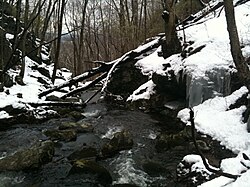
Cussgutter Brook in Winter - Tunxis Compounce Cascade Side Trail
|
|
| Length | 79 mi (127 km) |
| Location | Hartford / New Haven counties, Connecticut, USA |
| Designation | CFPA Blue-Blazed Tunxis Trail System |
| Use | hiking, cross-country skiing, snowshoeing, other |
| Elevation | |
| Highest point | Pine Mountain, 1,378 ft (420 m) |
| Lowest point | Farmington River, 150 ft (46 m) |
| Hiking details | |
| Trail difficulty | easy, with difficult sections |
| Season | easiest spring to fall |
| Hazards | hunters, deer ticks, poison ivy |
The Tunxis Trail is a 79-mile (127 km) Blue-Blazed hiking trail "system" that traverses the western ridge of the central Connecticut valley. The mainline (official "Blue" and "non-dot") trail is not completely contiguous, notably there are two gaps of several miles (between the Southington and Burlington sections and between the Burlington section and the Nepaug section).
The Tunxis Trail is composed of eighteen (18) trails of which one is the primarily North-to-South mainline trail plus a number of shorter side trails. Despite being easily accessible and close to large population centers, the trail is considered remarkably rugged and scenic.
Notable features include the Lake Compounce Amusement Park (and its "non-ski lift"), "Tory Den", the "Mile of Ledges", colonial era cemeteries, several caves (including the "Indian Council Caves"), waterfalls, dramatic cliff faces, woodlands, swamps, lakes, river flood plains, farmland, significant historic sites, and the summits of Pine Mountain and Southington Mountain. The Tunxis Trail, maintained largely through the efforts of the Connecticut Forest and Park Association.
The Tunxis Trail system, at approximately 79 miles in length, is the longest of the Blue-Blazed Trails maintained by the Connecticut Forest and Park Association.
Because the trail runs parallel to the Metacomet Trail there are several spectacular views from the Tunxis Trail of Metacomet Ridge features to the east.
The Tunxis Trail extends from the Connecticut / Massachusetts border north to south crossing successively the municipalities of Hartland in Hartford County, Barkhamsted and New Hartford in Litchfield County, Canton and Burlington in Hartford County, Harwinton and Plymouth in Litchfield County, ending in Bristol and Southington in Hartford County with two southern side trails touching the northern New Haven County town of Wolcott.
...
Wikipedia
