Tulliallan
| Tulliallan | |
|---|---|
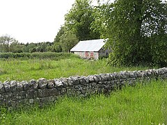
 Building in fields in Devilla Forest. Most of the land here is wooded, and has been for many years. The forest was shown as Tulliallan Forest on older maps |
|
| Tulliallan shown within Fife | |
| Council area | |
| Lieutenancy area | |
| Country | Scotland |
| Sovereign state | United Kingdom |
| Post town | Kincardine |
| Police | Scottish |
| Fire | Scottish |
| Ambulance | Scottish |
| EU Parliament | Scotland |
| UK Parliament | |
| Scottish Parliament | |
Tulliallan (Gaelic tulach-aluinn, 'Beautiful knoll') was an estate in Perthshire, Scotland, near to Kincardine, and a parish. The Blackadder lairds of Tulliallan, a branch of the Blackadder border clan, wielded considerable power in the 15th and 16th centuries. The modern Tulliallan Castle is relatively recent, built in 1812-1820 and now the home of the Scottish Police College
The original parish of Tulliallan covered only the barony of Tulliallan. In 1673 it was extended to include the barony of Kincardine and the lands of Lurg, Sands and Kellywood, formerly included in the neighboring Culross parish. For many years the parishes of Culross and Tulliallan formed an exclave some miles away from the rest of Perthshire, on the boundaries of Clackmannanshire and Fife. Culross and Tulliallan were transferred to Fife based on the recommendations of the boundary commission appointed under the Local Government (Scotland) Act 1889.
The parish is bounded on the west and north by Clackmannan, on the east by Culross and on the south by the River Forth. It is 3.75 miles (6.04 km) from north to south and 3 miles (4.8 km) from east to west, and contains 4,176 acres (1,690 ha). In 1885, 484 acres (196 ha) were foreshore and 106 acres (43 ha) water. The parish slopes gently southward to the Forth from a height of 324 feet (99 m) Between 1823 and 1839 a large area of land was recovered from the tidal waters of the Forth by two large embankments. The 1885 description said about 500 acres (200 ha) was wooded and almost all the rest cultivated. High-quality sandstone had been quarried near Longannet for many years. The land was also rich in coal and ironstone.
The first fortification at Tulliallan was built some time before 1304, when it was ordered to be strengthened by Edward I of England. The position was strategic, near the main ferry over the Forth, and in 1304 Edward I gave orders for the walls of "Tolyalwyn" to be strengthened. Presumably this would have included strengthening the D-shaped moat and the outer rampart, making the position strong against attack across the marshy land, which would not be drained until the 18th century. There would have been buildings within the enclosure, but the old castle was probably built later, by the Douglasses.
...
Wikipedia

