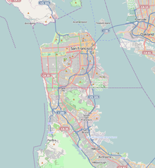
Treasure Island (California)
|
Treasure Island Magic Isle |
|
|---|---|
| Landform and neighborhood | |
![Treasure Island is "5,520 feet long by 3,410 feet wide"[1] and has the Treasure Island Marina on the south near Yerba Buena Island (bottom)](http://upload.wikimedia.org/wikipedia/commons/thumb/b/b8/Wfm_yerba_buena_treasure_islands_usgs.jpg/200px-Wfm_yerba_buena_treasure_islands_usgs.jpg)
Treasure Island is "5,520 feet long by 3,410 feet wide" and has the Treasure Island Marina on the south near Yerba Buena Island (bottom)
|
|
 Treasure Island is the northernmost area of San Francisco's District 6 |
|
| Location within San Francisco | |
| Coordinates: 37°49′30″N 122°22′16″W / 37.825°N 122.371°WCoordinates: 37°49′30″N 122°22′16″W / 37.825°N 122.371°W | |
| Country |
|
| State |
|
| City-county | San Francisco |
| Constructed | 1936–37 |
| Named for | Treasure Island (novel) |
| Government | |
| • Supervisor | Jane Kim (Dist. 6) |
| • Assemblymember | David Chiu (D) |
| • State senator | Scott Wiener (D) |
| • U. S. rep. | Nancy Pelosi (D) |
| Area | |
| • Total | 0.9 sq mi (2 km2) |
| • Land | 0.9 sq mi (2 km2) |
| • Water | 0 sq mi (0 km2) 0% |
| Population (2011 estimate) | |
| • Total | 2,300 |
| • Density | 2,600/sq mi (990/km2) |
| Time zone | Pacific (UTC-8) |
| • Summer (DST) | PDT (UTC-7) |
| ZIP code | 94130 |
| Area codes | 415/628 |
| GNIS feature IDs |
236528 (island) 2624152 (Building 157) 2506912 (Job Corps Ctr) |
| Website | Treasure Island Development Authority |
| Reference no. | 987 |
| Images | |
|---|---|
|
|
|
| Video | |
|
|
Treasure Island is an artificial island in San Francisco Bay and a neighborhood of the City of San Francisco. Built 1936–37 for the 1939 Golden Gate International Exposition, the island's World’s Fair site is a California Historical Landmark. Buildings there have been listed on the National Register of Historic Places, and the historical Naval Station Treasure Island and auxiliary air facility (for airships, blimps, dirigibles, planes and seaplanes) are designated in the Geographic Names Information System.
The San Francisco neighborhood that includes Treasure Island extends far into San Francisco Bay and includes a tip of Alameda Island. Yerba Buena and Treasure islands together have a land area of 576.7 acres (233.4 ha) with a 2010 total population of 2,500. Treasure Island is connected by a 900 ft (270 m) causeway to Yerba Buena Island, which in turn has on- and off-ramps to Interstate 80 on the San Francisco–Oakland Bay Bridge.
The island has a marina and a bikeway connecting to the newly completed Eastern span replacement of the San Francisco–Oakland Bay Bridge. Raised walkways circumscribe nearly the entire island along five streets (Avenue of the Palms, Perimeter Road, Avenue N, Pan American World Airways Esplanade and Clipper Cove Way, formerly known as 1st Street).
...
Wikipedia

