Town of Cottesloe
|
Town of Cottesloe Western Australia |
|||||||||||||
|---|---|---|---|---|---|---|---|---|---|---|---|---|---|

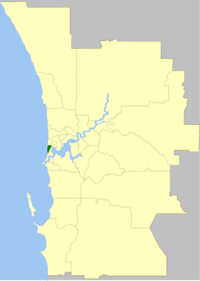
Location of Cottesloe, Western Australia
|
|||||||||||||
| Population | 8,572 (2013 est) | ||||||||||||
| • Density | 2,198/km2 (5,690/sq mi) | ||||||||||||
| Established | 1895 | ||||||||||||
| Area | 3.9 km2 (1.5 sq mi) | ||||||||||||
| Mayor | Jo Dawkins | ||||||||||||
| Council seat | Cottesloe | ||||||||||||
| Region | West Metropolitan Perth | ||||||||||||
| State electorate(s) | Cottesloe | ||||||||||||
| Federal Division(s) | Curtin | ||||||||||||
 |
|||||||||||||
| Website | Town of Cottesloe | ||||||||||||
|
|||||||||||||
The Town of Cottesloe is a local government area and a suburb of Perth, the capital of Western Australia. Cottesloe is located 11 kilometres (7 mi) west of Perth's central business district, covers an area of 3.9 square kilometres (1.5 sq mi), maintains 45.7 km of roads and has a population of 7,256 (2006).
The Cottesloe Road District was created on 4 October 1895 and became a Municipal District on 20 September 1907. In 1950 it bought Overton Lodge from Claude de Bernales and renamed it to the Cottesloe Memorial Town Hall and Civic Centre. On 1 July 1961, it became a Town following the enactment of the Local Government Act 1960.
The town has been divided into 4 wards. The mayor is directly elected.
The suburb of Cottesloe is the only suburb within this local government area, but four short streets with the suburb of Claremont fall under its jurisdiction.
Coordinates: 31°59′35″S 115°45′25″E / 31.993°S 115.757°E
...
Wikipedia
