Torrey Hills
| Torrey Hills, San Diego | |
|---|---|
| Community of San Diego | |
| Torrey Hills | |
 Torrey Hills boundaries and surrounding communities |
|
| Location within Northwestern San Diego | |
| Coordinates: 32°54′41″N 117°13′34″W / 32.911261°N 117.226089°W | |
| Country | |
| State |
|
| County |
|
| City |
|
Coordinates: 32°54′40.54″N 117°13′33.92″W / 32.9112611°N 117.2260889°W
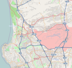
Torrey Hills is a community of 784 acres (317 ha) located in northern San Diego, California, United States.
Torrey Hills is bordered to the north by State Route 56 and Carmel Valley, to the northeast by Carmel Valley, to the south and southeast by Los Peñasquitos Canyon and Mira Mesa, and to the west by Interstate 5.
In 1979 when Carmel Valley was being planned, the city had conducted studies on the Los Peñasquitos Canyon Preserve as an open space park, but,had not determined the boundary of the park. The city then designated Sorrento Hills (now Torrey Hills) as Future Urbanizing on the General Plan.
In February 1980, Genstar-Peñasquitos (now AG Land Associates, LLC) dedicated a total of 1,806 acres (731 ha) of Los Peñasquitos Canyon to the city. This created a border for the preserve. As a result, a community planning program was initiated, and the original plan area was transferred from Future Urbanizing to Planned Urbanizing on the General Plan, excluding 178 acres (72 ha) adjacent to the Sorrento Hills community planning area, which was designated as Future Urbanizing.
...
Wikipedia

