Topsail Island

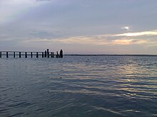
Topsail Island sound side
|
|
| Geography | |
|---|---|
| Location | Atlantic Ocean |
| Coordinates | 34°28′11″N 77°28′19″W / 34.46972°N 77.47194°W |
| Length | 26 mi (42 km) |
| Administration | |
|
USA
|
|
| Additional information | |
| Official website | http://www.topsailbeach.org/ |
Topsail Island is a 26-mile (41.8 km) long barrier island off the coast of North Carolina, USA just south of Camp Lejeune, the Bogue Banks, and the Outer Banks. It contains the communities of North Topsail Beach, Surf City and Topsail Beach. Along with its thick maritime forests, Topsail Island is also a sanctuary for sea turtles and known for its beautiful beaches. The island lies in Onslow County in the north, and in Pender County in the south. There are only two ways on and off the island: the first is a high rise bridge on the North End and the second is a swing bridge into Surf City.
Topsail Island's name is supposedly derived from its nefarious history, however, this is still debatable among the locals on the Island. According to popular belief,pirates used to hide in the channel between the island and the mainland waiting for merchant ships loaded with goods to pass. The pirates would attack the ships and claim the cargo as their own. Eventually the merchants became aware of the hiding place and began looking for the topsail, which was supposedly the only part of the pirate ship that could be seen by the passing victim. There is a legend that Blackbeard hid his treasure on Topsail Island and that prior to WWII, treasure hunters searched for the hidden gems and gold throughout the islands' maritime forests.
Prior to World War II, Topsail Island was only accessible by boat. Area residents frequently made this short trip and picnicked on the sandy shores of the Atlantic Ocean. Local farmers are said to have driven their livestock across the waterways at low tide to graze on wild beach grass. Treasure hunters searched for Blackbeard’s infamous buried treasure throughout the maritime forests which covered the island. During the early 20th century only a few structures, probably less than a dozen, were built along the sound and were used as shelter for fishing trips and summer vacations. At the beginning of World War II, the U.S. Army built a large temporary anti-aircraft training base at Holly Ridge known as Camp Davis and took possession of the island. They built the road from Camp Davis to the sound and installed a pontoon bridge across the Intracoastal Waterway where the present swing bridge is located. They also erected training facilities and support buildings in what is now the Surf City business district.
...
Wikipedia

