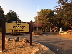
Topanga State Park
| Topanga State Park | |
|---|---|
|
IUCN category III (natural monument or feature)
|
|

The entrance to the Trippet Ranch area of Topanga State Park
|
|
| Location | Los Angeles County, California, USA |
| Nearest city | Los Angeles, CA |
| Coordinates | 34°5′43″N 118°32′56″W / 34.09528°N 118.54889°WCoordinates: 34°5′43″N 118°32′56″W / 34.09528°N 118.54889°W |
| Area | 11,000 acres (45 km2) |
| Established | 1964 |
| Governing body | CA Dept. of Parks & Recreation |
Topanga State Park is a California state park located in the Santa Monica Mountains, within Los Angeles County, California. It is part of the Santa Monica Mountains National Recreation Area.
The park is located adjacent to the community of Topanga, within the City of Los Angeles. Covering 11,000 acres (45 km²), with thirty-six miles of trails and unimproved roads, the park’s boundaries stretch from Topanga Canyon to Pacific Palisades and Mullholland Drive. There are more than 60 trail entrances. Topanga State Park is not only the largest park in the Santa Monica Mountains, but it's also considered to be the largest park located in the limits of a city.
The word Topanga is an old Shoshonean language word meaning 'above' and referring to the canyon settlement being above the flood waters of Topanga Creek. The Tongva and Chumash peoples inhabited the area for thousands of years. The land of Topanga Canyon was originally inhabited by Native American groups collectively referred to as the Topanga Culture, including the Chumash and Tongva.
Juan Rodriguez Cabrillo first claimed California for Spain in 1542. The Topanga region was not invaded until after the establishment of the Pueblo de Los Angeles and Mission San Fernando Rey de España in the late 1700s. When Mexico gained its independence from Spain in 1821, control of Alta California went to the new government. In 1828 the Mexican Governor of Alta California granted Francisco Sepulveda provisional title to the more than 30,000 acres called Rancho San Vicente y Santa Monica. The rancho included the eastern portion of the City of Santa Monica, Santa Monica Canyon, and the mountains to the ridgeline on the west bank of Topanga Creek. The land remained relatively unused, except for flat portions used for crops and grazing. The steeper sections were deemed unusable, even for sheep and cattle.
...
Wikipedia


