Tonkawa, Oklahoma
| Tonkawa, Oklahoma | |
|---|---|
| City | |

Tonkawa in late 2013.
|
|
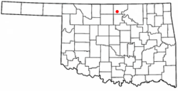
 Location of Tonkawa, Oklahoma |
|
| Coordinates: 36°40′49″N 97°18′33″W / 36.68028°N 97.30917°WCoordinates: 36°40′49″N 97°18′33″W / 36.68028°N 97.30917°W | |
| Country | United States |
| State | Oklahoma |
| County | Kay |
| Area | |
| • Total | 5.6 sq mi (14.5 km2) |
| • Land | 5.6 sq mi (14.5 km2) |
| • Water | 0.0 sq mi (0.1 km2) |
| Elevation | 984 ft (300 m) |
| Population (2010) | |
| • Total | 3,216 |
| • Density | 591.3/sq mi (228.3/km2) |
| Time zone | Central (CST) (UTC-6) |
| • Summer (DST) | CDT (UTC-5) |
| ZIP code | 74653 |
| Area code(s) | 580 |
| FIPS code | 40-74150 |
| GNIS feature ID | 1098940 |
Tonkawa is a city in Kay County, Oklahoma, United States, along the Salt Fork Arkansas River. The population was 3,216 at the 2010 census, a decline of 2.5 percent from 3,299 at the 2000 census.
Named after the Tonkawa tribe, the city of Tonkawa was founded in March 1894, by Eli V. Blake and Wiley William Gregory. Blake and Gregory, originally from Kansas, claimed the land that would become Tonkawa in the Land Run of 1893. Prior to the land run, from 1879 to 1885, this area was home to the Nez Perce. The Blackwell and Southern Railway (later bought by the Atchison, Topeka and Santa Fe Railway) built a line through Tonkawa, which stimulated growth of the town. In 1901, the Oklahoma Territory Legislature established the University Preparatory School (now Northern Oklahoma College) here. By statehood, the population was 1,238. The discovery of oil caused a boom in the 1920s, and the population was 3,311 in 1930.
During World War II, Tonkawa was home to Camp Tonkawa, a Prisoner of War camp. Camp Tonkawa remained in operation from August 30, 1943 to September 1, 1945. Built between October and December 1942, the 160-acre (0.65 km2) site contained more than 180 wooden structures for 3,000 German POW's as well as 500 U.S. Army guard troops, service personnel and civilian employees. The first prisoners, consisting of German troops from the Afrika Corps, arrived in August 1943. During their internment, prisoners labored at local farms and ranches. In November 1943, a prison riot caused the death of a German soldier, Johannes Kunze. Eight prisoners briefly escaped, only to be recaptured.
Tonkawa is located at 36°40′49″N 97°18′33″W / 36.68028°N 97.30917°W (36.680362, -97.309219). It is on the Salt Fork of the Arkansas River, 14 miles (23 km) west of Ponca City. According to the United States Census Bureau, the city has a total area of 5.6 square miles (15 km2), of which 5.6 square miles (15 km2) is land and 0.04 square miles (0.10 km2) (0.36%) is water.
...
Wikipedia
