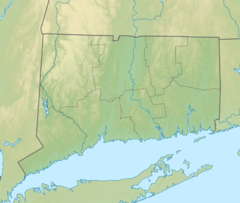
Tongue Point Light

Bridgeport Breakwater Light
|
|
|
Connecticut
|
|
| Location |
Bridgeport Harbor Connecticut United States |
|---|---|
| Coordinates | 41°09′59.8″N 73°10′39″W / 41.166611°N 73.17750°WCoordinates: 41°09′59.8″N 73°10′39″W / 41.166611°N 73.17750°W |
| Year first constructed | 1895 |
| Automated | 1954 |
| Foundation | reinforced concrete pier |
| Construction | cast iron tower |
| Tower shape | conical frustum tower with balcony and lantern |
| Markings / pattern | black tower and lantern |
| Height | 31 ft (9.4 m) |
| Focal height | 31 ft (9.4 m) |
| Original lens | Sixth order Fresnel lens |
| Current lens | 155 mm lens |
| Range | 5 nautical miles (9.3 km; 5.8 mi) |
| Characteristic | Fl G 4s. |
| Admiralty number | J0832 |
| ARLHS number | USA-1235 |
| USCG number | 1-24635 |
| Managing agent | Wisvest-Connecticut LLC |
Tongue Point Light Lighthouse, also known as Bridgeport Breakwater or Bug Light, is a lighthouse on the west side of the Bridgeport Harbor entrance, in the city of Bridgeport, Connecticut in the United States. It was added to the National Register of Historic Places in 1990.
The lighthouse was originally built at the end of a breakwater about 500 feet (150 m) offshore. In 1919, the shipping channel was widened and the lighthouse was moved 275 feet (84 m) inland. The light was automated in 1954. In 1967, the Coast Guard planned to remove the lighthouse but local boaters protested. The lighthouse remains an active aid to navigation. A modern optic replaced the original sixth order Fresnel lens in 1988.
In 1990 Tongue Point Light was added to the National Register of Historic Places under reference number 89001478.
...
Wikipedia

