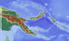
Tonda Wildlife Management Area
| Tonda Wildlife Management Area | |
|---|---|
|
IUCN category VI (protected area with sustainable use of natural resources)
|
|

Aerial view of the area near Bensbach airfield
|
|
|
Location in New Guinea
|
|
| Location | Western Province, Papua New Guinea |
| Nearest city | Merauke |
| Coordinates | 9°00′05″S 141°32′40″E / 9.00139°S 141.54444°ECoordinates: 9°00′05″S 141°32′40″E / 9.00139°S 141.54444°E |
| Area | 5,900 km2 (2,300 sq mi) |
| Established | 1975 |
| Designated | March 16, 1993 |
The Tonda Wildlife Management Area is a wetland of international importance and the largest protected area in Papua New Guinea. It is located in the south-western corner of the Western Province and is contiguous with Wasur National Park of Indonesia. It forms part of the Trans Fly savanna and grasslands ecoregion.
The terrain is flat, generally less than 45 metres above sea level. It includes tidal river reaches, mangrove areas, swamps, grassland, savanna woodlands and patches of monsoon forest. Most trees are of the genus Acacia and Melaleuca while common grasses are Phragmite and Pseudoraphis.
It is an important wetland for over 250 species of resident and migratory waterbirds. Most of the World's population of little curlew stage on the plains during migration. The area also provides habitat for birds-of-paradise and brolga.
Fifty-six species of fish have been recorded. Fifty mammals are known to occur in the area, including a number not found elsewhere in New Guinea, such as the spectacled hare-wallaby, false water-rat, bronze quoll and chestnut dunnart. Reptiles include saltwater crocodile and New Guinea crocodile.
...
Wikipedia

