Thurncourt
| Thurncourt | |
|---|---|
 |
|
| Population | 10,596 (2011) |
| Unitary authority | |
| Ceremonial county | |
| Region | |
| Country | England |
| Sovereign state | United Kingdom |
| Post town | LEICESTER |
| Postcode district | LE5 |
| Dialling code | 0116 |
| Police | Leicestershire |
| Fire | Leicestershire |
| Ambulance | East Midlands |
| EU Parliament | East Midlands |
| UK Parliament | |
Coordinates: 52°38′17″N 1°03′36″W / 52.638°N 1.060°W
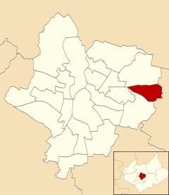
Thurncourt is an electoral ward and administrative division of the city of Leicester, England. The population of the ward at the 2011 census was 10,596. It comprises the suburb and housing estate of Thurnby Lodge in eastern Leicester.
Thurncourt is bounded by the wards of Evington to the south, and Humberstone & Hamilton to the north. Roughly, it consists of the area inside the city boundary which is north of the Uppingham Road, east of the A563 outer ringroad, and south of the Scraptoft Lane.
The area south of the main shops on Thurncourt Road, towards the parallel railway embankment, was originally mainly unlandscaped country land with a natural stream running through it. The stream divides at a point opposite Thurncourt Road shops into two further tributaries, one which continues on towards the city and the other taking a route southwards under tunnels beneath the railway embankment. This natural area was extensively landscaped in several phases by the Leicester City Council and a floodplain added up until the present day, destroying a natural fertile habitat for the then common water voles and small fresh water fish found within the habitat.
It is near but not part of Thurnby (to the south-east), after which it is named. Other nearby places are Humberstone (north and west), Scraptoft (east), Evington (south) and Goodwood, Leicestershire (south).
...
Wikipedia
