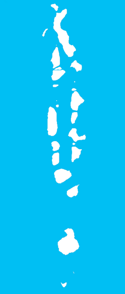
Thuraakunu (Haa Alif Atoll)
|
Thuraakunu ތުރާކުނު |
|
|---|---|
| Island | |
| Location in Maldives | |
| Coordinates: 7°6′18″N 72°54′07″E / 7.10500°N 72.90194°ECoordinates: 7°6′18″N 72°54′07″E / 7.10500°N 72.90194°E | |
| Country | Maldives |
| Geographic atoll | Ihavandhippolhu Atoll |
| Administrative atoll | Haa Alif Atoll |
| Distance to Malé | 329.89 km (204.98 mi) |
| Government | |
| • Council | Thuraakunu Island Council |
| Dimensions | |
| • Length | 0.9 km (0.6 mi) |
| • Width | 0.38 km (0.24 mi) |
| Population (2006) | |
| • Total | 347 |
| Time zone | MST (UTC+05:00) |
| Area code(s) | 650, 20 |
| Location | Thuraakunu Haa Alif Atoll Maldives |
|---|---|
| Coordinates | 7°06′19.4″N 72°53′42.7″E / 7.105389°N 72.895194°E |
| Foundation | concrete basement |
| Construction | metal skeletal tower |
| Tower shape | square pyramidal skeletal tower |
| Focal height | 15 metres (49 ft) |
| Light source | solar power |
| Range | 10 nautical miles (19 km; 12 mi) |
| Characteristic | Fl W 5s. |
| Admiralty number | F0762.9 |
| NGA number | 27394 |
Thuraakunu (Dhivehi: ތުރާކުނު) is the northern-most island in Maldives, one of the fourteen inhabited islands of Haa Alif Atoll and is geographically part of the Ihavandhippolhu Atoll in the Maldives. It is an island-level administrative constituency governed by the Thuraakunu Island Council.
Thuraakunu is the closest island to Minicoy. Formerly there was direct trade between both, and fishermen from both islands used to visit each other. This exchange continued even after Minicoy became part of the Indian Union after independence. However, after 1956 the Indian government forbade these visits. Now, despite the geographical proximity and ethnographic similarities, people from both islands are not allowed to meet each other.
...
Wikipedia

