Thornbury and Yate
| Thornbury and Yate | |
|---|---|
|
County constituency for the House of Commons |
|

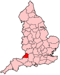
Boundary of Thornbury and Yate in Avon.
|
|

Location of Avon within England.
|
|
| County | Gloucestershire |
| Electorate | 64,736 (December 2010) |
| Major settlements | Thornbury, Yate and Chipping Sodbury |
| Current constituency | |
| Created | 2010 |
| Member of parliament | Luke Hall (Conservative Party) |
| Number of members | One |
| Created from | Northavon |
| Overlaps | |
| European Parliament constituency | South West England |
Coordinates: 51°34′23″N 2°28′37″W / 51.573°N 2.477°W
Thornbury and Yate is a constituency represented in the House of Commons of the UK Parliament since the 2015 election by Luke Hall, a Conservative. Encompassing an area to the north-east of Bristol, it is one of three constituencies that make up the South Gloucestershire Unitary Authority Area, along with Filton and Bradley Stoke and Kingswood.
This seat is a successor to the former Northavon constituency, which was abolished following boundary changes taking effect at the 2010 general election. It is named after the two largest towns in the constituency: Thornbury and Yate.
Following the Fifth Periodic Review of Westminster constituencies by the Boundary Commission this newly defined seat emerged. The electoral wards used in the creation of this new seat are all from the district of South Gloucestershire and are as follows:
...
Wikipedia
