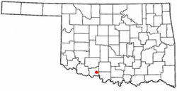
Temple, Oklahoma
| Temple, Oklahoma | |
|---|---|
| Town | |
 Location of Temple, Oklahoma |
|
| Coordinates: 34°16′16″N 98°14′5″W / 34.27111°N 98.23472°WCoordinates: 34°16′16″N 98°14′5″W / 34.27111°N 98.23472°W | |
| Country | United States |
| State | Oklahoma |
| County | Cotton |
| Area | |
| • Total | 1.3 sq mi (3.4 km2) |
| • Land | 1.3 sq mi (3.4 km2) |
| • Water | 0.0 sq mi (0.0 km2) |
| Elevation | 1,007 ft (307 m) |
| Population (2010) | |
| • Total | 1,102 |
| • Density | 876.8/sq mi (338.5/km2) |
| Time zone | Central (CST) (UTC-6) |
| • Summer (DST) | CDT (UTC-5) |
| ZIP code | 73568 |
| Area code(s) | 580 |
| FIPS code | 40-72750 |
| GNIS feature ID | 1098797 |
Temple is a town in Cotton County, Oklahoma, United States. It is 5 miles (8.0 km) south and 5 miles (8.0 km) east of Walters, the county seat. The population was 1,102 at the 2010 census, a decline of 12.6 percent from 1,146 at the 2000 census. The town is named for the celebrated trial lawyer of Texas and Oklahoma Territory, Temple Lea Houston (1860–1905), the youngest son of General Sam Houston.
Temple is located at 34°16′16″N 98°14′5″W / 34.27111°N 98.23472°W (34.271175, -98.234785).
According to the United States Census Bureau, the town has a total area of 1.3 square miles (3.4 km2), all of it land.
As of the census of 2000, there were 1,146 people, 488 households, and 301 families residing in the town. The population density was 876.8 people per square mile (337.8/km²). There were 604 housing units at an average density of 462.1 per square mile (178.0/km²). The racial makeup of the town was 75.65% White, 11.34% African American, 4.89% Native American, 0.17% Asian, 4.71% from other races, and 3.23% from two or more races. Hispanic or Latino of any race were 7.24% of the population.
...
Wikipedia
