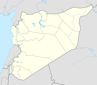
Tell Kazel
| Region | Tartus Governorate |
|---|---|
| Coordinates | 34°42′29″N 35°59′10″E / 34.708056°N 35.986111°E |
| Type | Tell |
| Part of | Ancient city |
| Length | 350m |
| Width | 325m |
| Area | 11 hectares (110,000 m2) |
| History | |
| Material | stone, flints, pottery |
| Periods | Bronze Age |
| Site notes | |
| Excavation dates | 1956, 1960–1968, 1985- |
| Archaeologists | Maurice Dunand, N. Saliby, A. Bounn, Leila Badre, Assaad Seif |
| Condition | Ruins |
| Management | Directorate-General of Antiquities and Museums |
| Public access | Yes |
Tell Kazel is an oval-shaped tell that measures 350 metres (1,150 ft) by 325 metres (1,066 ft) at its base, narrowing to 200 metres (660 ft) by 200 metres (660 ft) at its top. It is located in the Safita district of the Tartus Governorate in Syria in the north of the Akkar plain on the north of the al-Abrash river approximately 18 kilometres (11 mi) south of Tartus.
The tell was first surveyed in 1956 after which a lengthy discussion was opened by Maurice Dunand and N. Saliby identifying the site with the ancient city variously named Sumur, Simyra or Zemar (Egypt. Smr Akkad. Sumuru or Assyrian Simirra). The ancient city is mentioned in the Bible, Book of Genesis (Genesis 10:18) and 1 Chronicles (1 Chronicles 1:16) as the home of the Zemarites, an offshoot of the Caananites. It was a major trade center and appears in the Amarna letters; Ahribta is named as its ruler. It was under the guardianship of Rib-Hadda, king of Byblos, but revolted against him and joined Abdi-Ashirta's expanding kingdom of Amurru. Pro-Egyptian factions may have seized the city again but Abdi-Ashirta's son Aziru recaptured the city.
...
Wikipedia

