Tell Halula
| Location | 105 km (65 mi) east of Aleppo, Syria |
|---|---|
| Region | Euphrates |
| Coordinates | 36°25′00″N 38°10′00″E / 36.416667°N 38.166667°E |
| Type | Tell |
| Part of | Village |
| Length | 300 metres (980 ft) |
| Width | 150 metres (490 ft) |
| Area | 8 hectares (860,000 sq ft) |
| History | |
| Material | bones, flints, pottery, plaster |
| Founded | c. 7750 |
| Abandoned | c. 6780 BC |
| Periods | PPNB, Neolithic |
| Site notes | |
| Excavation dates | 1991- |
| Archaeologists | Miquel Molist |
| Condition | Ruins |
| Management | Directorate-General of Antiquities and Museums |
| Public access | Yes |
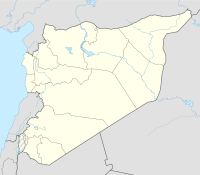
Tell Halula is a large, prehistoric, neolithic tell, about 8 hectares (860,000 sq ft) in size, located around 105 kilometres (65 mi) east of Aleppo and 25 kilometres (16 mi) northwest of Membij in the Raqqa Governorate of Syria.
The tell was first excavated in 1991 by the Spanish Archaeological Mission, directed by Miquel Molist, Professor of Prehistory at the Universitat Autònoma de Barcelona. Archaeological trenches have covered an area of approximately 2,500 square metres (27,000 sq ft).
The large mound is located on the steppe of nearby mountains at an altitude of 349 metres (1,145 ft) above sea level and was found to be approximately 8 metres (26 ft) deep. It is situated between Wadi Fars and Wadi Abu Gal Gal on the right bank and fluvial plain of the Euphrates. It is one of the largest neolithic sites yet found, described as a megasite, including the remains of twenty one rectangular houses of three to five rooms, nine with associated burials of at least one hundred and seven incomplete skeletons. Burials were made under the floors of the houses, which were typically covered with a limestone plaster.
Occupation of the site was detected from the middle of Pre-Pottery Neolithic B (PPNB) at around 7750 BC into the neolithic around 6780 BC and has provided insight into the transitions during this period, especially the emergence of agriculture during the neolithic revolution. Forty levels of occupation have been detected with levels one to twenty dating to the middle PPNB; twenty-one to thirty-four dating to the late PPNB; and two later levels, thirty-six and thirty-seven, showing evidence of the Halaf culture. Various arrowheads were found which were largely classed as Byblos points. Several showed signs of lime plaster around the tangs, which has been suggested to have been the method of fixing to the arrow's shaft. Excavations revealed paintings of female figures on the floor of one of the buildings, which are suggested to be the oldest paintings of people in the Middle East.
...
Wikipedia

