Tamarindo, Costa Rica
| Tamarindo | |
|---|---|
| District and Town | |

The coastline in Tamarindo
|
|
| Location in Costa Rica | |
| Coordinates: 10°17′57″N 85°50′24″W / 10.29917°N 85.84000°WCoordinates: 10°17′57″N 85°50′24″W / 10.29917°N 85.84000°W | |
| Country |
|
| Province | Guanacaste |
| Area | |
| • District and Town | 123.53 km2 (47.70 sq mi) |
| Population (November 2011) | |
| • District and Town | 6,375 |
| • Density | 51.6/km2 (134/sq mi) |
| • Urban | 49.2 |
| Time zone | Costa Rica Standard Time (UTC-6) |
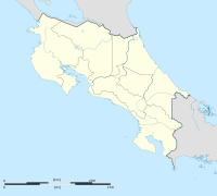
Tamarindo is a town and district of the Santa Cruz canton, located on the Nicoya Peninsula on the Northern Pacific coast of Costa Rica in the Province of Guanacaste. The district has a population (as of 2011) of 6,375 (3rd Biggest district of Santa Cruz, second being Veintisiete de Abril and first Santa Cruz it self). The main attractions are surfing and eco-tourism.
Towns belonging to the district besides Tamarindo are Villarreal, Santa Rosa, Garita Nueva, Hernández and San José de Pinilla.
Playa Tamarindo is a long, rocky beach, with excellent waves near the mouth of the estuary. Currents can be strong, especially on a falling tide. Tamarindo has two main breaks for advanced surfers: Pico Pequeño a rocky point to the right of the Hotel Tamarindo Diriá and the excellent river mouth break across from Cabinas Tsunami called El Estero. The rest of the beach breaks are perfect for learning. The biggest waves can reach a height of up to 12 feet, although this is a rare occurrence and is only seen during November and December.
Some eco-friendly activities that may be done in Tamarindo and Neighboring beaches include, watching turtles during their nesting season, diving, snorkeling, body surfing, zip-lining, estuary trips, horseback riding and fishing. During the December to April period when the water turbidity is low, fishing may be done from the shore.
The beaches in the area are generally clean and recent efforts by the government and local business organizations are proving themselves. While the beach has not regained its Blue Flag Status, in September 2008, it did get a clean bill of health from the Costa Rican Government. The town is trying to regain its Blue Flag Status.
ATV Tours - Combo Tours - Estuary Safari - Horseback Riding - Kayak Tours - Massages - White Water Rafting class or Tubing - Rincon de la Vieja Tours - Scuba Diving - Shuttles & Transfers - Snorkeling - Spa & Beauty - Sport Fishing - Sailing - Sunset Sailing - Surfing Lessons - Tennis Classes - Turtle Nesting Tours - Zip Line / Canopy Tours
Tamarindo is the most accessible location along the northern Pacific coast of Costa Rica with an airstrip, Scheduled daily bus service to and from San José, paved highway from San José with an average driving time of 3.5 to 6 hours depending on traffic.
...
Wikipedia

