Tagbilaran Airport
|
Tagbilaran International Airport Tugpahanan sa Tagbilaran (Cebuano) Paliparan ng Tagbilaran (Tagalog) |
|||||||||||
|---|---|---|---|---|---|---|---|---|---|---|---|

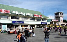
Tagbilaran Airport terminal building
|
|||||||||||
| Summary | |||||||||||
| Airport type | Public | ||||||||||
| Operator | Civil Aviation Authority of the Philippines | ||||||||||
| Serves | Tagbilaran | ||||||||||
| Location | Barangay Taloto, Tagbilaran | ||||||||||
| Elevation AMSL | 12 m / 38 ft | ||||||||||
| Coordinates | 09°39′50.69″N 123°51′11.69″E / 9.6640806°N 123.8532472°ECoordinates: 09°39′50.69″N 123°51′11.69″E / 9.6640806°N 123.8532472°E | ||||||||||
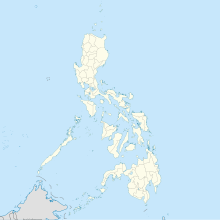
| Map | |||||||||||
| Location in the Philippines | |||||||||||
| Runways | |||||||||||
|
|||||||||||
| Statistics (2016) | |||||||||||
|
|||||||||||
|
|||||||||||
| Passengers | 871,383 |
|---|---|
| Aircraft movements (2012) | 3,686 |
| Metric tonnes of cargo (2012) | 3,273 |
Tagbilaran Airport (Cebuano: Tugpahanan sa Tagbilaran, Tagalog: Paliparan ng Tagbilaran) (IATA: TAG, ICAO: RPVT) is an airport serving the general area of Tagbilaran, the capital city of the province of Bohol in the Philippines. The airport is classified as a Principal Airport Class 1 by the CAAP, a body of the Department of Transportation and Communications responsible for implementing policies on civil aviation to assure safe, economic and efficient air travel, and the handling of operations on all airports except major international airports.
The 2013 Bohol earthquake caused damage including the collapse of a ceiling in the control tower. Operations were suspended for three hours but later resumed.
...
Wikipedia

