Sunderland Bridge (Massachusetts)
| Sunderland Bridge | |
|---|---|
 |
|
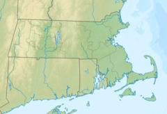
| Coordinates | 42°28′03″N 72°35′06″W / 42.46750°N 72.58500°WCoordinates: 42°28′03″N 72°35′06″W / 42.46750°N 72.58500°W |
| Crosses | Connecticut River |
| Locale | South Deerfield, Massachusetts to Sunderland, Massachusetts |
| Characteristics | |
| Design | deck truss |
| Total length | 1,177 ft (358.7 m) |
The Sunderland Bridge is a crossing over the Connecticut River in western Massachusetts, connecting the towns of South Deerfield and Sunderland, carrying Massachusetts Route 116.
There was at least one preceding bridge at this location, a metal through-truss bridge destroyed by the floating Montague City Covered Bridge during the Flood of 1936.
The current Sunderland Bridge is a deck truss bridge completed in 1937. Reconstruction of the bridge was completed in 1994. Replacement of the original art deco railings by modern ones was controversial.
...
Wikipedia

