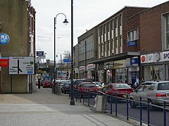
Strood, Kent
| Strood | |
|---|---|
 High Street, Strood |
|
| Strood shown within Kent | |
| Population | 33,182 |
| OS grid reference | TQ725695 |
| Unitary authority | |
| Ceremonial county | |
| Region | |
| Country | England |
| Sovereign state | United Kingdom |
| Post town | ROCHESTER |
| Postcode district | ME2 |
| Dialling code | 01634 |
| Police | Kent |
| Fire | Kent |
| Ambulance | South East Coast |
| EU Parliament | South East England |
| UK Parliament | |
Strood is a town in the unitary authority of Medway in South East England. It was, until 1998, part of Kent and is still ceremonially associated via the Lieutenancies Act. It lies on the northwest bank of the River Medway at its lowest bridging point, and is part of the Rochester post town.
Strood was part of Frindsbury until 1193, but now Frindsbury is considered part of Strood. Strood's history has been dominated by the river, the bridges and the road and rail links they carried. It is now a mainly residential suburb of Rochester, and a commuter town for London.
Strood comprises several named areas, notably Earl Estate and Marlowe Park.
Strood was part of Frindsbury until 1193. It was named "Strodes" in the Textus Roffensis, though most early records use the spelling Stroud. The Old English name Strōd refers to a "marshy land overgrown with brushwood".
The Romans built a stone bridge and laid a road on a causeway across the marshy ground. The foundations were about 8 ft below the level of the 1856 road. The road went up Strood Hill, and was called Watling Street, as it still is today. This is the A2 road . There is further evidence of a causewayed road leading along the bank towards the Frindsbury Peninsula leading to a villa, was found in 1819. The present road and field pattern suggest that there was a substantial Roman agricultural settlement centred near Frindsbury.
In 764 AD Offa King of Mercia and Sigered King of Kent granted to Eardulph lands in Easlingham (Frindsbury). In 840, 994, and 998 AD Strood was pillaged by the Danes. In 960 AD a wooden bridge was built across the Medway.
...
Wikipedia

