Stroma, Scotland
| Norse name | Straumøy or Straumsey |
|---|---|
| Meaning of name | Island in the stream |
| Location | |
|
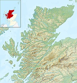
Stroma shown within Highland Scotland
|
|
| OS grid reference | ND 35105 77539 |
| Coordinates | 58°40′48″N 3°07′12″W / 58.680°N 3.120°WCoordinates: 58°40′48″N 3°07′12″W / 58.680°N 3.120°W |
| Physical geography | |
| Area | 375 hectares (930 acres) |
| Area rank | 78= |
| Highest elevation | Cairn Hill 53 m (174 ft) |
| Administration | |
| Sovereign state | United Kingdom |
| Country | Scotland |
| Council area | Highland |
| Demographics | |
| Population | 0 |

Stroma Lighthouse
|
|
|
Orkney
|
|
| Location | Stroma Island 2 mi (3 km) north of Gills Bay Caithness Scotland United Kingdom |
|---|---|
| Coordinates | 58°41′45.2″N 03°07′00.1″W / 58.695889°N 3.116694°W |
| Year first constructed | 1890 |
| Automated | 1997 |
| Construction | masonry tower |
| Tower shape | cylindrical tower with balcony and lantern attached to 1-storey keeper's house |
| Markings / pattern | white tower, black lantern, ochre trim |
| Height | 23 metres (75 ft) |
| Focal height | 32 metres (105 ft) |
| Range | 26 nautical miles (48 km; 30 mi) |
| Characteristic | Fl (2) W 20s. |
| Admiralty number | A3568 |
| NGA number | 3032 |
| ARLHS number | SCO-228 |
| Managing agent |
Northern Lighthouse Board |
Stroma is an island off the northern coast of the mainland of Scotland. It is the most southerly of the islands in the Pentland Firth between the Orkney islands and Caithness, the northeasternmost part of the mainland. The name is from the Old Norse Straumr-øy meaning "island in the [tidal] stream".
The island's population fell from 375 people in 1901 to just 12 by 1961. The last native islanders left at the end of the following year, while Stroma's final abandonment came in 1997 when the lighthouse keepers and their families departed. Ancient stone structures testify to the presence of Stroma's earliest residents, while a Norse presence around 900–1,000 years ago is recorded in the Orkneyinga Saga. It has been politically united with Caithness since at least the 15th century. Although Stroma lies only a few miles off the Scottish coast, the savage weather and ferociously strong tides of the Pentland Firth meant that the island's inhabitants were very isolated, causing them to be largely self-sufficient, trading agricultural produce and fish with the mainlanders.
Most of the islanders were fishermen and crofters; some also worked as maritime pilots to guide vessels through the treacherous waters of the Pentland Firth. The tides and currents meant that shipwrecks were frequent—the most recent occurring in 1993—and salvage provided an additional though often illegal supplement to the islanders' incomes. A lighthouse was built on Stroma in 1890 and still operates under automation.
Stroma is now abandoned, with the houses of its former inhabitants unoccupied and falling into ruin. Its population fell gradually through the first half of the 20th century as inhabitants drifted away to seek opportunities elsewhere, as economic problems and Stroma's isolation made life on the island increasingly unsupportable. From an all-time peak of 375 people in 1901, the population fell to just 12 by 1961 and the last islanders left at the end of the following year. The island is now owned by one of its former inhabitants, who uses it to graze cattle and sheep.
Stroma is located in the Pentland Firth about 2 miles (3.2 km) northwest of John o' Groats on the mainland. The island divides the firth into two channels, the Inner Sound to the south and the Outer Sound to the north. It is mostly low-lying and flat, covering an area of around 375 hectares (930 acres) and rising to a height of 53 m (174 ft) at Cairn Hill in the southeast. It is oriented in a north-south direction, measuring about 2 miles (3.2 km) long by 1 mile (1.6 km) wide.
...
Wikipedia


