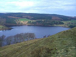
Strines Reservoir
| Strines Reservoir | |
|---|---|

Seen from the high ground to the south at Boots Folly
|
|
| Location | Bradfield Dale, South Yorkshire |
| Coordinates | 53°24′36″N 1°39′21″W / 53.4099°N 1.6557°WCoordinates: 53°24′36″N 1°39′21″W / 53.4099°N 1.6557°W |
| Type | reservoir |
| Basin countries | United Kingdom |
| Surface area | 22 ha (54 acres) |
| Water volume | 452.9×10⁶ imp gal (2.059×10⁶ m3; 1,669 acre·ft) |
Strines Reservoir is a water storage reservoir situated at 53°24′36″N 1°39′21″W / 53.4099°N 1.6557°W, 8 miles (13 km) west of the centre of Sheffield in South Yorkshire, England.
The reservoir was constructed in 1869 after the Sheffield Water Committee made the decision in the late 1850s to build four reservoirs in Bradfield Dale to impound water from the surrounding moorland to provide for the growing town of Sheffield. Sheffield had previously received its water supply from the Crookesmoor dams close to the town centre but by the mid-19th century these were becoming inadequate.
In addition to Strines, three other reservoirs were built: Damflask, Agden and Dale Dike. Strines was meant to be the final of the four reservoirs constructed; however, Dale Dike was not completed until 1875, having to be rebuilt after the failure of its dam wall caused the Great Sheffield Flood of 1864. Strines Reservoir was constructed with a dam wall of approximately 330 metres (1083 feet) in length and 29 metres (95 feet) in height which flooded an area of 22 hectares. It holds 452,900,000 gallons of water.
The name Strines dates from as early as the 13th century, when it was mentioned in the Sheffield Court records as the Water of the Strynd or Strynds, referring to the stream that rose on the moors at the top end of Bradfield Dale and flowed down the valley to join the River Loxley at Low Bradfield. The Oxford English Dictionary defines the word strynds or strinds as a rivulet or a stream.
...
Wikipedia
