Stirling Castle
| Stirling castle | |
|---|---|
| Stirling, Scotland | |
|
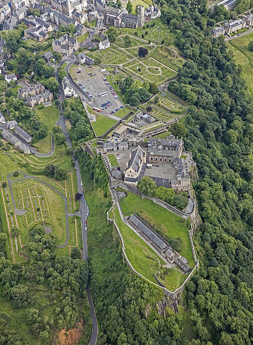
Aerial view of Stirling Castle
Aerial view of Stirling Castle
|
|
|
Location within Stirling council area
|
|
| Coordinates | 56°7′26″N 3°56′56″W / 56.12389°N 3.94889°WCoordinates: 56°7′26″N 3°56′56″W / 56.12389°N 3.94889°W |
| Grid reference | grid reference NS789940 |
| Site information | |
| Owner | Historic Scotland |
| Open to the public |
Yes |
| Site history | |
| Built | Castle dates from at least early 12th century, present buildings mostly built between 1490 and 1600 |
| Built by | Significant works by James IV, James V, and James VI |
| In use | Still in use today |
| Battles/wars | Sieges and occupations during the Wars of Scottish Independence (1296–1357); sieges in 1651, 1746 |
| Garrison information | |
| Current commander |
James Erskine, 14th Earl of Mar |
| Past commanders |
Hereditary office of the Earls of Mar |
Stirling Castle (Scottish Gaelic: Caisteal Shruighlea), located in Stirling, is one of the largest and most important castles in Scotland, both historically and architecturally. The castle sits atop Castle Hill, an intrusive crag, which forms part of the Stirling Sill geological formation. It is surrounded on three sides by steep cliffs, giving it a strong defensive position. Its strategic location, guarding what was, until the 1890s, the farthest downstream crossing of the River Forth, has made it an important fortification from the earliest times. Most of the principal buildings of the castle date from the fifteenth and sixteenth centuries. A few structures of the fourteenth century remain, while the outer defences fronting the town date from the early eighteenth century. Several Scottish Kings and Queens have been crowned at Stirling, including Mary, Queen of Scots, in 1542. There have been at least eight sieges of Stirling Castle, including several during the Wars of Scottish Independence, with the last being in 1746, when Bonnie Prince Charlie unsuccessfully tried to take the castle. Stirling Castle is a Scheduled Ancient Monument, and is now a tourist attraction managed by Historic Scotland.
Castle Hill, on which Stirling Castle is built, forms part of the Stirling Sill, a formation of quartz-dolerite around 350 million years old, which was subsequently modified by glaciation to form a "crag and tail". It is likely that this natural feature was occupied at an early date, as a hill fort is located on Gowan Hill, immediately to the east. The Romans bypassed Stirling, building a fort at Doune instead, but the rock may have been occupied by the Maeatae at this time. It may later have been a stronghold of the Manaw Gododdin, and has also been identified with a settlement recorded in the 7th and 8th centuries as Iudeu, where King Penda of Mercia besieged King Oswy of Bernicia in 655. The area came under Pictish control after the defeat of the Northumbrians at the Battle of Dun Nechtain thirty years later. However, there is no archaeological evidence for occupation of Castle Hill before the late medieval period.
...
Wikipedia


