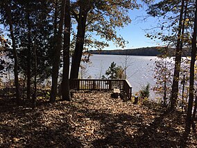
Staunton River State Park
| Staunton River State Park, Virginia, USA | |
|---|---|

Staunton River State Park
|
|
| Location of Staunton River State Park | |
| Location | 1170 Staunton Trail, Scottsburg, VA 24589 |
| Coordinates | 36°41′45.8″N 78°41′7″W / 36.696056°N 78.68528°WCoordinates: 36°41′45.8″N 78°41′7″W / 36.696056°N 78.68528°W |
| Area | 2,336 acres (945 ha) |
| Governing body | Virginia Department of Conservation and Recreation |
|
Staunton River State Park Historic District
|
|

A cabin in the park
|
|
| Nearest city | Scottsburg, Virginia |
|---|---|
| Area | 1,597 acres (646 ha) |
| Built | 1933 |
| Architectural style | Late 19th And Early 20th Century American Movements, Modern Movement |
| NRHP Reference # | 07000402 |
| VLR # | 041-0100 |
| Significant dates | |
| Added to NRHP | May 4, 2007 |
| Designated VLR | June 8, 2006 |
Staunton River State Park is a state park in Virginia. One of the Commonwealth's original state parks, built by the Civilian Conservation Corps and opening in 1936, it is located along the Staunton River near Scottsburg, Virginia. It is an International Dark Sky Park.
Construction of the park was begun (at the confluence of the Staunton and Dan Rivers) beginning in 1933; Buggs Island Lake was formed in the early 1950s. These two rivers form the Roanoke River basin, and the section of land starting at the park and continuing downstream beside the Roanoke River was known as the Roanoke River valley.
The park is named for the Staunton River, which forms part of its boundary. Today the river is also known as the Roanoke River; however, locally it is still called the Staunton River (pronounced "Stanton"). The Staunton River is said to be named for Captain Henry Staunton; before the American Revolution, Staunton commanded a company of soldiers organized to patrol the river valley from the Blue Ridge Mountains to the mouth of the Dan River. Their duty was to protect early European settlers from attacks by Native Americans. This section of the river became known as “Captain Staunton’s River” and, later, the Staunton River.
The first Europeans who settled were small farmers. With the introduction of tobacco as a cash crop, area plantations began to expand. Many plantations were located along the Staunton River above the park. Red Hill (the last home of Patrick Henry) and Roanoke Plantation (home of Captain Adam Clement and his son John Marshall Clemens, father of Samuel Clemens—Mark Twain) are two of the better-known plantations. The Fork Plantation was located on what is now Staunton River State Park. H. E. Coleman owned the plantation, and in 1839 the ownership was transferred to Richard Logan. The plantation contained all of the land located on the fork; one tract covered more than 1,000 acres (4.0 km2). At this time, there was also a Fork Mission located near the present town of Scottsburg.
...
Wikipedia


