Stafford Castle
| Stafford Castle | |
|---|---|
| Staffordshire, England | |

Stafford Castle
|
|
| Coordinates | 52°47′50″N 2°08′48″W / 52.7973°N 2.1468°WCoordinates: 52°47′50″N 2°08′48″W / 52.7973°N 2.1468°W |
| Grid reference | grid reference SJ902222 |
| Type | Motte and bailey, later Gothic Revival |
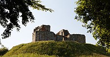
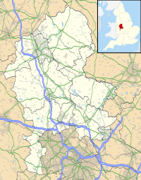
Stafford Castle is an ancient Grade II listed building that lies two miles to the west of Stafford, just off the A518 Stafford-to-Newport Road. It is a local landmark and can be seen from the M6 motorway and also from the West Coast mainline inter-city trains. The stone building is an important early example of a 14th-century keep, later redesigned in a Gothic Revival style. The structure was built on the foundations of its medieval predecessor and incorporates much of the original stonework.
The early historian of Staffordshire Robert Plot cited the Anglo-Saxon Chronicle (104) for evidence that Æthelflæd, the Saxon warrior-princess and ruler of the Mercians, built a castle at Stafford in the year 913, along with an adjacent burg (meaning a fortified town). However, the exact site of this first castle, probably made of wood, is now unknown.
Shortly before the castle was built the Saxon Eadric the Wild had led a failed rebellion which culminated in the defeat of the Saxons at the Battle of Stafford in 1069.
A wooden castle was originally built on the site at some time in the 1070s by the Norman lord Robert de Tosny who had been given a large amount of land in the area by William of Normandy in order to control and extract taxes from the native Anglo-Saxon community. The castle was originally a timber and earth fortification, built on modified glacial deposit. The artificial horizon of the motte or mound is still well defined, as are many of the ditches. The earthworks cover over ten acres, while the site backs onto woodland (sixteen acres), which may once have been cleared for housing livestock. Beyond these earthworks once lay three medieval deer parks.
The first castle was built in the classic motte and bailey style, although it incorporated two baileys and a village beyond. The outline of the site's defences can still be seen today. The banks and ditches have been interpreted by an archaeological illustrator whose watercolours feature on a Heritage Trail which encompasses much of the ten acre site. The trail takes 45 minutes to walk, with short-cuts which are either fifteen minutes (trial-boards 1—5 and straight up the inner bailey gateway) or ten minutes (board 1 and 10 which is straight up the modern drive). Each of the boards has a map, so it is difficult to get lost.
...
Wikipedia

