St. Peter's Island

St. Peter’s Island as seen from Twann/Douanne
|
|
| Geography | |
|---|---|
| Location | Lake Biel |
| Highest elevation | 474 m (1,555 ft) |
| Administration | |
| Canton | Berne |
| Districts |
Biel/Bienne Seeland |
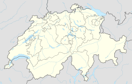
St. Peter’s Island (German: Sankt Petersinsel; is a peninsula and former island situated in Lake Bienne in the canton of Berne, Switzerland. It has a length of about 5 kilometres (3.1 mi) and a maximum width of 800 metres (2,600 ft). Its highest point is 474 metres (1,555 ft) above sea level or 45 metres (148 ft) above lake level (429 m [ 1,407 ft ]). It was formed in the last Ice Age (see ), when the Rhône Glacier reached as far as the Jura mountains. It is a promontory of the Jolimont, above Cerlier. Politically the island is split between the municipalities of Erlach and Twann-Tüscherz, the largest part belonging to the latter municipality.
In the late nineteenth century following the engineering works of the Jura water correction, the water-level of the three lakes of the Seeland have dropped enough to clear the until-then hidden isthmus, linking Cerlier to St. Peter’s Island, which has ever since become a peninsula, although separated from the shore by a canal.
Monks of the Cluniac order were the first inhabitants of the island, and built a monastery here in 1127.
Before his expulsion, Jean-Jacques Rousseau, spent two months on the island in 1765 calling it the "happiest time of his life".
Coordinates: 47°04′15″N 7°08′33″E / 47.07083°N 7.14250°E
...
Wikipedia

