Springfield, Georgia
| Springfield, Georgia | |
|---|---|
| City | |
| Motto: "Where What's Close to Your Heart Still Matters" | |
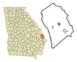
 Location in Effingham County and the state of Georgia |
|
| Coordinates: 32°22′6″N 81°18′37″W / 32.36833°N 81.31028°WCoordinates: 32°22′6″N 81°18′37″W / 32.36833°N 81.31028°W | |
| Country | United States |
| State | Georgia |
| County | Effingham |
| Government | |
| • Mayor | Barton Alderman |
| Area | |
| • Total | 2.7 sq mi (7.1 km2) |
| • Land | 2.7 sq mi (7.1 km2) |
| • Water | 0 sq mi (0 km2) |
| Elevation | 79 ft (24 m) |
| Population (2010) | |
| • Total | 2,852 |
| • Density | 1,034/sq mi (399.3/km2) |
| Time zone | EST (UTC-5) |
| • Summer (DST) | EDT (UTC-4) |
| ZIP code | 31329 |
| Area code(s) | 912 |
| FIPS code | 13-72780 |
| GNIS feature ID | 0333107 |
| Website | City of Springfield Georgia |
Springfield is a city in Effingham County, Georgia, United States. The population was 2,852 at the 2010 census, up from 1,821 in 2000. The city is the county seat of Effingham County. Springfield is part of the Savannah Metropolitan Statistical Area.
Springfield is the seat of government for Effingham County.Ebenezer was the county seat from 1797 to 1799. In 1799, Effingham County had three different county seats. The state legislature appointed a commission to select a new centrally located site for the permanent county seat. A location five miles from the center of the county was chosen and named Springfield, for the plantation of General David Blackshear.
The county government surveyed the new town, and designated streets, lots, and the public squares that were to be used for the courthouse and the jail. The lots were sold to finance the construction of these public buildings. A map drawn in 1821 shows four north–south streets and nine east–west streets. Development of the new county seat was slow, as it was isolated from customary routes of trade. At the turn of the 20th century, it was listed as having only about twelve houses.
A 1907 map showed the railroad had come to town, an impetus for growth. Four new east–west streets had been added, as well as several new north–south streets. This period saw the greatest growth in Springfield. The Brinson Railroad from Savannah was built about 1907, as was the George M. Brinson Sawmill. In 1908 a new county courthouse was constructed. In the decade from 1900 to 1910, the population of Springfield increased to 500 from 134.
Throughout the 19th- and early 20th-century, the courthouse square served as the nucleus of town activity and the anchor around which the community was planned. The courthouse was usually surrounded by public space or by a square. Houses emerged on the fringes of the square, and growth would usually radiate from the courthouse, developing a square town plan. Springfield has examples of such development, but much early architecture was lost due to a series of fires from the late 19th century through the 1960s. Springfield's 1908 courthouse, designed in the classical Greek style as a symbol of republican government, is an example of the courthouse as town anchor.
...
Wikipedia
