Spiringen
| Spiringen | ||
|---|---|---|
 |
||
|
||
| Coordinates: 46°52′N 8°44′E / 46.867°N 8.733°ECoordinates: 46°52′N 8°44′E / 46.867°N 8.733°E | ||
| Country | Switzerland | |
| Canton | Uri | |
| District | n.a. | |
| Area | ||
| • Total | 64.73 km2 (24.99 sq mi) | |
| Elevation | 923 m (3,028 ft) | |
| Population (Dec 2015) | ||
| • Total | 846 | |
| • Density | 13/km2 (34/sq mi) | |
| Postal code | 6464 | |
| SFOS number | 1218 | |
| Surrounded by | Bürglen, Glarus Süd (GL), Muotathal (SZ), Schattdorf, Unterschächen | |
| Website |
www SFSO statistics |
|
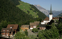
Spiringen is a village and a municipality in the canton of Uri in Switzerland. The municipality comprises two disjoint areas, separated by the municipality of Unterschächen and the Klausen Pass. The western area includes the village of Spiringen in the Schächen Valley, whilst the eastern area includes the Urnerboden alp above Linthal and the canton of Glarus.
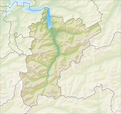
Spiringen has an area, as of 2006[update], of 64.7 km2 (25.0 sq mi). This area is split into two parts, with the slightly smaller part around the village of Spiringen in the valley of the Schächen, which drains westward towards the Reuss and Lake Lucerne. This part is surrounded by the municipalities of Bürglen and Schattdorf to the north and west, and the municipality of Unterschächen to the east and south. Some 8 kilometres (5.0 mi) away, on the eastern side of Unterschächen and the Klausen Pass, is the second and larger part of the municipality. This comprises the Urnerboden meadows, and drains eastward into the Linth and Lake Zürich. Besides Unterschächen to its west, this part is surrounded on its north by the municipality of Muotathal in the canton of Schwyz, and on its south and east by the municipality of Glarus Süd in the canton of Glarus.
...
Wikipedia


