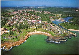
South West Rocks, New South Wales
|
South West Rocks New South Wales |
|||||||
|---|---|---|---|---|---|---|---|

South West Rocks
|
|||||||
| Coordinates | 30°53′03″S 153°02′25″E / 30.88417°S 153.04028°ECoordinates: 30°53′03″S 153°02′25″E / 30.88417°S 153.04028°E | ||||||
| Population | 4,816 (2011 census) | ||||||
| Postcode(s) | 2431 | ||||||
| Location | 40 km (25 mi) from Kempsey | ||||||
| LGA(s) | Kempsey Shire | ||||||
| State electorate(s) | Oxley | ||||||
| Federal Division(s) | Cowper | ||||||
|
|||||||
| South West Rocks | ||||||||||||||||||||||||||||||||||||||||||||||||||||||||||||
|---|---|---|---|---|---|---|---|---|---|---|---|---|---|---|---|---|---|---|---|---|---|---|---|---|---|---|---|---|---|---|---|---|---|---|---|---|---|---|---|---|---|---|---|---|---|---|---|---|---|---|---|---|---|---|---|---|---|---|---|---|
| Climate chart () | ||||||||||||||||||||||||||||||||||||||||||||||||||||||||||||
|
||||||||||||||||||||||||||||||||||||||||||||||||||||||||||||
|
||||||||||||||||||||||||||||||||||||||||||||||||||||||||||||
| J | F | M | A | M | J | J | A | S | O | N | D |
|
148
27
20
|
171
27
20
|
181
26
19
|
170
24
17
|
132
22
14
|
138
19
12
|
77
19
11
|
80
20
12
|
57
22
13
|
91
23
15
|
117
25
17
|
119
26
18
|
| Average max. and min. temperatures in °C | |||||||||||
| Precipitation totals in mm | |||||||||||
| Imperial conversion | |||||||||||
|---|---|---|---|---|---|---|---|---|---|---|---|
| J | F | M | A | M | J | J | A | S | O | N | D |
|
5.8
80
67
|
6.7
81
67
|
7.1
79
66
|
6.7
75
62
|
5.2
71
58
|
5.4
67
54
|
3
66
52
|
3.2
68
53
|
2.2
71
56
|
3.6
74
59
|
4.6
76
62
|
4.7
79
Wikipedia
...
|

