South Hampton, NH
| South Hampton, New Hampshire | |
|---|---|
| Town | |
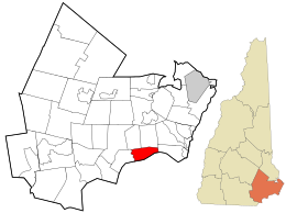
 Location in Rockingham County and the state of New Hampshire. |
|
| Coordinates: 42°52′51″N 70°57′45″W / 42.88083°N 70.96250°WCoordinates: 42°52′51″N 70°57′45″W / 42.88083°N 70.96250°W | |
| Country | United States |
| State | New Hampshire |
| County | Rockingham |
| Incorporated | 1742 |
| Government | |
| • Board of Selectmen | James Van Bokkelen, Chair John Gamble Ron Preston |
| Area | |
| • Total | 8.0 sq mi (20.7 km2) |
| • Land | 7.9 sq mi (20.4 km2) |
| • Water | 0.1 sq mi (0.3 km2) 1.62% |
| Elevation | 200 ft (61 m) |
| Population (2010) | |
| • Total | 814 |
| • Density | 100/sq mi (39/km2) |
| Time zone | Eastern (UTC-5) |
| • Summer (DST) | Eastern (UTC-4) |
| ZIP code | 03827 |
| Area code(s) | 603 |
| FIPS code | 33-71140 |
| GNIS feature ID | 0873722 |
| Website | www |
South Hampton is a town in Rockingham County, New Hampshire, United States. The population was 814 at the 2010 census, which is less than every other town within 15 miles. South Hampton is home to Cowden State Forest and Powwow River State Forest.
South Hampton was one of the first towns granted by Colonial Governor Benning Wentworth after the separation of the governorships of New Hampshire and Massachusetts in 1741. The border between the two colonies was fixed, and consequently South Hampton would be chartered in 1742 from former parts of Amesbury and Salisbury, Massachusetts. Over the years, the town lost territory to Hampton Falls, Seabrook and Newton, but gained territory from East Kingston in 1824.
The town's Justices of the Peace in 1831 were Parker Merrill, George W. Pillsbury, Benning Leavitt, John Palmer and A. Brown.
At one time, the town was home to over 12 different religious sects. One of South Hampton's only members of the New Hampshire State Senate was Benjamin Barnard, who served from 1806-1808.
There is only one school in South Hampton. Called Barnard School, it was originally just a small room, but then a school was built across the street. It is home to K-8 students, and once they become high schoolers, they move on to Amesbury High School in Massachusetts.
According to the United States Census Bureau, the town has a total area of 8.0 square miles (21 km2), of which 7.9 sq mi (20 km2) is land and 0.1 sq mi (0.26 km2) is water, comprising 1.62% of the town. South Hampton is drained by the Powwow River, part of the Merrimack River watershed. The highest point in town is the summit of Chair Hill, at 330 feet (100 m) above sea level, near the eastern end of town.
...
Wikipedia
