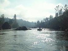
South Fork American River
| South Fork American River | |
|---|---|
 |
|
| Basin features | |
| Main source |
Sierra Nevada 38°48′38″N 120°01′52″W / 38.81056°N 120.03111°W |
| River mouth |
Folsom Lake 466 ft (142 m) 38°44′03″N 121°06′15″W / 38.73417°N 121.10417°WCoordinates: 38°44′03″N 121°06′15″W / 38.73417°N 121.10417°W |
| Progression | American–Sacramento |
| Basin size | 840 sq mi (2,200 km2) |
| Physical characteristics | |
| Length | 87 mi (140 km) |
| Discharge |
|
The South Fork American River is a major tributary of the American River in El Dorado County, California, draining a watershed on the western slope of the Sierra Nevada east of Sacramento. The river begins in pristine Desolation Wilderness and flows through the Sierra Nevada foothills. The river at Coloma was the site of James Marshall's discovery of gold at Sutter's Mill on January 24, 1848, which started the California Gold Rush. The South Fork of the American is now one of the most popular whitewater rafting destinations in North America.
The river begins at Nebelhorn near Johnson Pass about 10 mi (16 km) south of Lake Tahoe. From there it flows west for 87 mi (140 km), past the towns of Kyburz, Pollock Pines and Coloma, before emptying into Folsom Lake, the reservoir formed by the Folsom Dam. The North Fork American River also flows into the lake, and the combined rivers form the American River proper, which flows from the dam southwest to a confluence with the Sacramento River.
The South Fork drains an area of 840 sq mi (2,200 km2), or about a third of the 2,150 sq mi (5,600 km2) American River watershed. Major tributaries include Silver Creek, Rock Creek, Weber Creek, and Caple Creek. Most of the watershed consists of high, forested mountains and steep-sided valleys that receive up to 40 in (1,000 mm) of annual precipitation, except for the westernmost section which consists of drier foothill country. The river also contributes about a third of the total outflow of the American River system.
...
Wikipedia
